Latitude: 51.8284 / 51°49'42"N
Longitude: -1.744 / 1°44'38"W
OS Eastings: 417737
OS Northings: 214455
OS Grid: SP177144
Mapcode National: GBR 4R6.9X4
Mapcode Global: VHB28.Q9CN
Plus Code: 9C3WR7H4+99
Entry Name: Sherborne Farmhouse
Listing Date: 25 March 1987
Grade: II
Source: Historic England
Source ID: 1090410
English Heritage Legacy ID: 130665
ID on this website: 101090410
Location: Cotswold, Gloucestershire, GL54
County: Gloucestershire
District: Cotswold
Civil Parish: Sherborne
Traditional County: Gloucestershire
Lieutenancy Area (Ceremonial County): Gloucestershire
Church of England Parish: Sherborne St Mary Magdalene
Church of England Diocese: Gloucester
Tagged with: Farmhouse
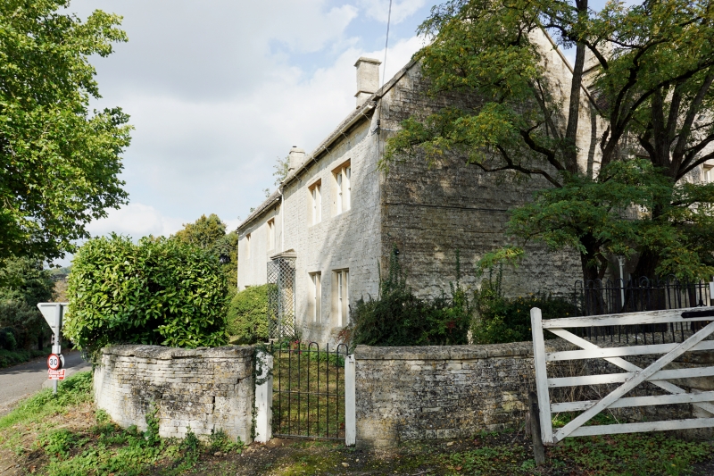
SHERBORNE SHERBORNE VILLAGE SP 1714 9/228 Sherborne Farmhouse GV II Detached farmhouse. Mid C19. Coursed squared and dressed limestone. Stone slate and red tile roofing, ashlar stacks. Two restored C20. Basically rectangular plan in two blocks roofed at slightly different levels with former wash house at right angles to north gable end. 2½ storeys. Two + 2-windowed entrance front facing road. Two-light stone-mullioned windows to first floor with 4-pane sashes. Two and 3-light stone-mullioned windows to ground floor. Three with relieving arches. All ground floor windows with 8-pane sashes. C19 part-glazed door off-centre right with flat stone canopy with moulded margin, supported on moulded brackets. Projecting, flat roofed stone porch at right gable end. Stacks at gable ends. Parallel ridged roof. Interior not inspected. (Property of the National Trust).
Listing NGR: SP1773714455
External links are from the relevant listing authority and, where applicable, Wikidata. Wikidata IDs may be related buildings as well as this specific building. If you want to add or update a link, you will need to do so by editing the Wikidata entry.


Other nearby listed buildings