Latitude: 51.7796 / 51°46'46"N
Longitude: -1.996 / 1°59'45"W
OS Eastings: 400370
OS Northings: 208991
OS Grid: SP003089
Mapcode National: GBR 2NT.66K
Mapcode Global: VHB2B.CJ4M
Plus Code: 9C3WQ2H3+RH
Entry Name: Tudor House
Listing Date: 12 February 1988
Grade: II
Source: Historic England
Source ID: 1090158
English Heritage Legacy ID: 131260
ID on this website: 101090158
Location: Woodmancote, Cotswold, Gloucestershire, GL7
County: Gloucestershire
District: Cotswold
Civil Parish: North Cerney
Traditional County: Gloucestershire
Lieutenancy Area (Ceremonial County): Gloucestershire
Church of England Parish: North Cerney All Saints
Church of England Diocese: Gloucester
Tagged with: House
NORTH CERNEY WOODMANCOTE SP 00 NW 6/237 Tudor House
GV II
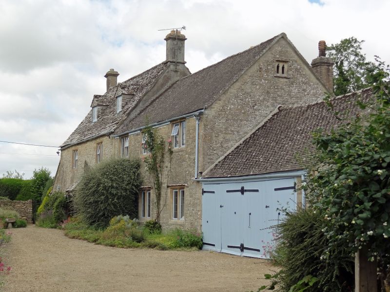
Detached house. Late C17-early C18. Stable added late C18-C19 (now converted). Limestone rubble with dressed stone quoins; stone slate roof with an ashlar and C20 imitation ashlar stack to main body; concrete tile to the later extensions. Rectangular plan to the converted outbuilding to the east gable end and lean-to extension to the west gable end. C20 extensions to the rear of the main body not of special interest. Main body: 2 storeys and attic and cellar. Converted outbuilding: 2 storeys with single-storey gable extension to the east gable end. Symmetrical 2-windowed facade lit by 2-light double-chamfered stone-mullioned casements; stopped hoods over the ground floor. Two 2-light slate-hung roof dormers. Central C20 part-glazed door within a flat-chamfered dressed stone surround under a C20 hipped canopy. Three-windowed converted outbuilding to the right lit by stone-mullioned casements. All casements with leaded panes. Interior not accessible. /
Listing NGR: SP0037008991
External links are from the relevant listing authority and, where applicable, Wikidata. Wikidata IDs may be related buildings as well as this specific building. If you want to add or update a link, you will need to do so by editing the Wikidata entry.


Other nearby listed buildings