Latitude: 51.6747 / 51°40'28"N
Longitude: -1.9292 / 1°55'45"W
OS Eastings: 404991
OS Northings: 197324
OS Grid: SU049973
Mapcode National: GBR 3RC.YX4
Mapcode Global: VHB2Y.H5ZJ
Plus Code: 9C3WM3FC+V8
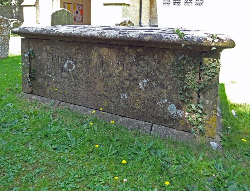
Entry Name: Hinton and Unidentified Monument About 7 Metres and 5 Metres South East of South East Corner of Porch in Churchyard of Church of All Hallows
Listing Date: 27 February 1986
Grade: II
Source: Historic England
Source ID: 1090055
English Heritage Legacy ID: 129528
ID on this website: 101090055
Location: All Hallows' Church, South Cerney, Cotswold, Gloucestershire, GL7
County: Gloucestershire
District: Cotswold
Civil Parish: South Cerney
Built-Up Area: South Cerney
Traditional County: Gloucestershire
Lieutenancy Area (Ceremonial County): Gloucestershire
Church of England Parish: South Cerney All Hallows
Church of England Diocese: Gloucester
Tagged with: Building
SOUTH CERNEY CHURCH LANE SU 0497-0597 (north side) 14/229 Hinton and Unidentified Monument about 7m and 5m south-east of south-east corner of porch in churchyard of Church of All Hallow GV II Two chest tombs. Beata Hinton, died 1740; unidentified, late C18/early C19. Limestone. Flat tops, moulded plinth and capping, plain sides and ends.
Listing NGR: SU0499197324
External links are from the relevant listing authority and, where applicable, Wikidata. Wikidata IDs may be related buildings as well as this specific building. If you want to add or update a link, you will need to do so by editing the Wikidata entry.


Other nearby listed buildings