Latitude: 51.6675 / 51°40'3"N
Longitude: -1.7686 / 1°46'6"W
OS Eastings: 416101
OS Northings: 196555
OS Grid: SU161965
Mapcode National: GBR 4T3.HNY
Mapcode Global: VHB31.9CC0
Plus Code: 9C3WM69J+2H
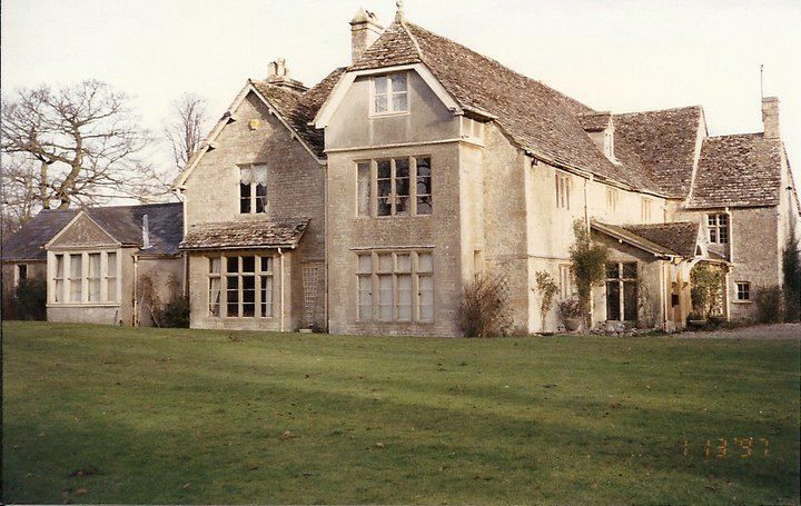
Entry Name: The Vicarage
Listing Date: 4 June 1952
Grade: II
Source: Historic England
Source ID: 1089454
English Heritage Legacy ID: 128948
ID on this website: 101089454
Location: Kempsford, Cotswold, Gloucestershire, GL7
County: Gloucestershire
District: Cotswold
Civil Parish: Kempsford
Built-Up Area: Fairford Airfield
Traditional County: Gloucestershire
Lieutenancy Area (Ceremonial County): Gloucestershire
Church of England Parish: Kempsford with Whelford
Church of England Diocese: Gloucester
Tagged with: Clergy house
SU 19 NE KEMPSFORD KEMPSFORD VILLAGE (south side)
8/103 The Vicarage
4.6.52 II
Large detached house. Late C17, with substantial C19 additions to west. Earlier part in rubble stone with quoins, C19 additions in coursed and dressed stone also with quoins. Stone slate roof with stone stacks with moulded cornices. Originally L-plan range, extended to form squarish range, mostly 2 storeys and attic. C17 range to south, which appears in Kip's engraving of Kempsford Manor of 1700, has 3 windows, 3-light, ovolo moulded stone mullions. One on ground floor to left, with string course between, rest obscured by large C19 lean-to porch across front with coloured glass. Cross gabled projecting wing to right probably slightly later. C19 additions mainly to south and west. One small gabled dormer to south on C17 range with 2-light wood casement.
Listing NGR: SU1610696557
External links are from the relevant listing authority and, where applicable, Wikidata. Wikidata IDs may be related buildings as well as this specific building. If you want to add or update a link, you will need to do so by editing the Wikidata entry.


Other nearby listed buildings