Latitude: 51.7833 / 51°46'59"N
Longitude: -2.0513 / 2°3'4"W
OS Eastings: 396559
OS Northings: 209406
OS Grid: SO965094
Mapcode National: GBR 2NQ.46B
Mapcode Global: VHB29.DFFR
Plus Code: 9C3VQWMX+8F
Entry Name: Manor Farmhouse
Listing Date: 24 June 1985
Grade: II
Source: Historic England
Source ID: 1088413
English Heritage Legacy ID: 127238
ID on this website: 101088413
Location: Winstone, Cotswold, Gloucestershire, GL7
County: Gloucestershire
District: Cotswold
Civil Parish: Winstone
Traditional County: Gloucestershire
Lieutenancy Area (Ceremonial County): Gloucestershire
Church of England Parish: Winstone St Bartholomew
Church of England Diocese: Gloucester
Tagged with: Farmhouse
SO 90 NE WINSTONE CHURCH LANE (east side) 6/138 Manor Farmhouse
GV II
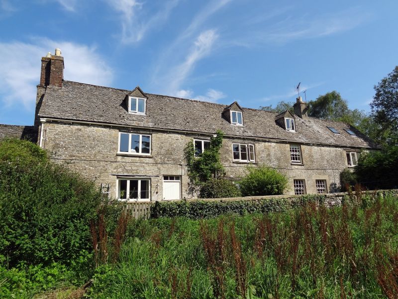
Formerly manor house; now 2 houses in row. Early C17; considerably altered in C19. Random rubble limestone; 1 artificial stone chimney, 2 red brick chimneys; stone slate roof. Two 2-storey houses in row; each has single-storey projecting back wing; garage addition on west end. South front: scattered fenestration; 2 doorways, 1 with 4-panel door, 1 with partly glazed C20 door, both with deep stone lintels; otherwise fenestration is Cl9 and C20 casements with timber or stone lintels; centre right two 16-pane sashes to ground floor with 1 above; 3 roof dormers. West end: projecting chimney stack with 2 rebuilt brick shafts. Back: wings have exposed purlins and plank doors with timber lintels; fenestration scattered as on front; plank doors to garage at west end. Almost all traces of the manorial status of this house have disappeared. Privy with dovecot in garden to north (q.v.). Listed for Group Value.
Listing NGR: SO9655809403
External links are from the relevant listing authority and, where applicable, Wikidata. Wikidata IDs may be related buildings as well as this specific building. If you want to add or update a link, you will need to do so by editing the Wikidata entry.


Other nearby listed buildings