Latitude: 52.8523 / 52°51'8"N
Longitude: -1.4353 / 1°26'7"W
OS Eastings: 438122
OS Northings: 328462
OS Grid: SK381284
Mapcode National: GBR 6FW.3YH
Mapcode Global: WHDH6.XKPP
Plus Code: 9C4WVH27+WV
Entry Name: Trent and Mersey Canal, Canal Milepost to South of Massey's Bridge at SK 381 284
Listing Date: 11 March 1987
Grade: II
Source: Historic England
Source ID: 1088350
English Heritage Legacy ID: 83242
ID on this website: 101088350
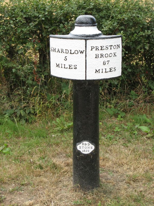
SK 32 NE PARISH OF SWARKESTONE SWARKESTONE ROAD 3/255 (West Side) Canal Milepost to South of Massey's Bridge at SK 381 284 II Canal milepost. 1819, produced by Rangeley and Dixon. Cast iron. Circular stem with shallow segmental plate near top and moulded circular head. The stem has a raised quatrefoil near the base inscribed 'R and D Stone 1819' and the plate has two panels, that to east inscribed 'SHARDLOW 5 MILES', and that to west inscribed 'PRESTON BROOK 87 MILES'. Erected as part of a series of mileposts on the Trent and Mersey Canal.
Listing NGR: SK3812228462
External links are from the relevant listing authority and, where applicable, Wikidata. Wikidata IDs may be related buildings as well as this specific building. If you want to add or update a link, you will need to do so by editing the Wikidata entry.


Other nearby listed buildings