Latitude: 53.2686 / 53°16'6"N
Longitude: -1.3526 / 1°21'9"W
OS Eastings: 443276
OS Northings: 374813
OS Grid: SK432748
Mapcode National: GBR LZZN.Z1
Mapcode Global: WHDFB.635L
Plus Code: 9C5W7J9W+CX
Entry Name: The Chantry
Listing Date: 25 February 1966
Grade: II
Source: Historic England
Source ID: 1088319
English Heritage Legacy ID: 83267
ID on this website: 101088319
Location: Staveley, Chesterfield, Derbyshire, S43
County: Derbyshire
District: Chesterfield
Civil Parish: Staveley
Built-Up Area: Staveley
Traditional County: Derbyshire
Lieutenancy Area (Ceremonial County): Derbyshire
Church of England Parish: Staveley St John the Baptist
Church of England Diocese: Derby
Tagged with: Building
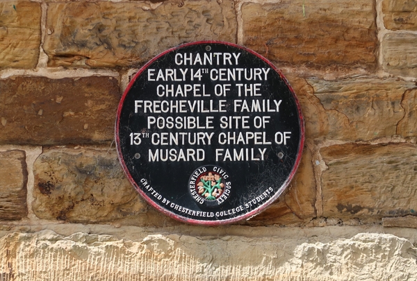
HIGH STREET 1. 1675A (West Side) No 39 SK 4374 1/12 25.2.66. (The Chantry) II 2. Medieval. It is said to have been a chantry founded by the Frecheville family or, alternatively, a chapel founded by the Musard family in the C13, but this has been disputed. Stone rubble; 2 storeys, with gabled end to road; 1 storey plus attic to right with 1 stone dormer; plain sashes, irregularly spaced; old stone slab roof. The interior has indications of massive timbering, particularly in the roof, where the timbers are oddly spaced out. A correct interpretation of the building architecturally would only be possible during a process of partial stripping out of later work. A number of skeletons were unearthed here in 1904. Unoccupied and much in need of repair at time of survey. Reference: Arthur Court, 'Staveley, my Native Town' 1948, with photograph.
Listing NGR: SK4327674813
External links are from the relevant listing authority and, where applicable, Wikidata. Wikidata IDs may be related buildings as well as this specific building. If you want to add or update a link, you will need to do so by editing the Wikidata entry.


Other nearby listed buildings