Latitude: 54.8122 / 54°48'43"N
Longitude: -2.4417 / 2°26'30"W
OS Eastings: 371711
OS Northings: 546462
OS Grid: NY717464
Mapcode National: GBR CDDS.5R
Mapcode Global: WH91V.G9JQ
Plus Code: 9C6VRH65+V8
Entry Name: Lyndhurst
Listing Date: 14 May 1984
Grade: II
Source: Historic England
Source ID: 1087003
English Heritage Legacy ID: 73077
ID on this website: 101087003
Location: Alston, Westmorland and Furness, Cumbria, CA9
County: Cumbria
District: Eden
Civil Parish: Alston Moor
Built-Up Area: Alston
Traditional County: Cumberland
Lieutenancy Area (Ceremonial County): Cumbria
Church of England Parish: Alston Moor
Church of England Diocese: Newcastle
Tagged with: Building
NY 7146 ALSTON MOOR A686 (west side), ALSTON Town Foot
24/17 Lyndhurst
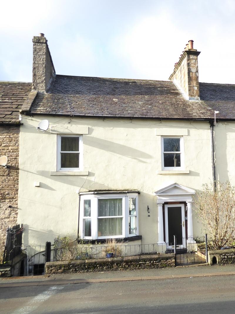
G.V. II House, mid C18 with later additions. Rendered rubble. Graduated slate roof has stone coping and corniced chimney to south end; 2nd, identical, chimney shared with property adjoining north end. 2-storey, 2-bay front has glazed door in pedimented, Tuscan doorcase. Later canted bay window to left; 2 sashes above, all without glazing bars.
Listing NGR: NY7171146462
External links are from the relevant listing authority and, where applicable, Wikidata. Wikidata IDs may be related buildings as well as this specific building. If you want to add or update a link, you will need to do so by editing the Wikidata entry.


Other nearby listed buildings