Latitude: 51.3302 / 51°19'48"N
Longitude: 1.413 / 1°24'46"E
OS Eastings: 637855
OS Northings: 164543
OS Grid: TR378645
Mapcode National: GBR X0L.J1Z
Mapcode Global: VHMCW.FTVM
Plus Code: 9F338CJ7+35
Entry Name: Nos 5, 7 and 9 Including Railed Areas and Gardens
Listing Date: 4 February 1988
Grade: II
Source: Historic England
Source ID: 1086092
English Heritage Legacy ID: 171994
ID on this website: 101086092
Location: Ramsgate, Thanet, Kent, CT11
County: Kent
District: Thanet
Town: Thanet
Civil Parish: Ramsgate
Built-Up Area: Ramsgate
Traditional County: Kent
Lieutenancy Area (Ceremonial County): Kent
Tagged with: House Terrace of houses
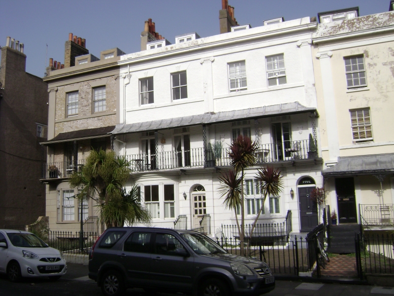
RAMSGATE ROYAL ROAD TR 3764 NE (east side) 12/358 Nos. 5, 7 + 9 including railed Areas and gardens GV II Terrace row. 1826-36. Painted brick, No. 9, pebbledash, with rendered base. Slate roof. Three storeys, basement and attic. Rusticated base, with string courses to 1st and second floors, and Ionic pilasters to cornice parapet to roof with 4 dormers and 3 stacks, left, centre left, and centre right. Four glazing bar sashes and 2 central sashes on second floor, six margin light French doors and rectangular fanlights on first floor with tented verandahs with trellised piers and simple rails, that to left (No. 9) glazed in Tripartite bows on ground floor with sashes and pilasters, and to right of each panelled doors with semi-circular fanlights. Sashes and half-glazed doors to basement. Fleur-de-lys rails to steps, basement areas and front gardens. Built , and to the same designs as, Nos. 11-17 and 4-44 as part of James Townley's redevelopment of the cavalry barracks site predating Spencer Square. (See Busson 109).
Listing NGR: TR3785564543
External links are from the relevant listing authority and, where applicable, Wikidata. Wikidata IDs may be related buildings as well as this specific building. If you want to add or update a link, you will need to do so by editing the Wikidata entry.


Other nearby listed buildings