Latitude: 51.2411 / 51°14'28"N
Longitude: 0.1022 / 0°6'7"E
OS Eastings: 546835
OS Northings: 151203
OS Grid: TQ468512
Mapcode National: GBR LM2.2NF
Mapcode Global: VHHPX.Q2CD
Plus Code: 9F3264R2+CV
Entry Name: Wellhead Canopy
Listing Date: 16 January 1975
Grade: II
Source: Historic England
Source ID: 1085842
English Heritage Legacy ID: 356939
ID on this website: 101085842
Location: Toy's Hill, Sevenoaks, Kent, TN16
County: Kent
District: Sevenoaks
Civil Parish: Brasted
Built-Up Area: Toy's Hill
Traditional County: Kent
Lieutenancy Area (Ceremonial County): Kent
Church of England Parish: Sundridge St Mary
Church of England Diocese: Rochester
Tagged with: Building
1. 5280 BRASTED TOYS HILL Wellhead canopy TQ 45 SE 45/81
II
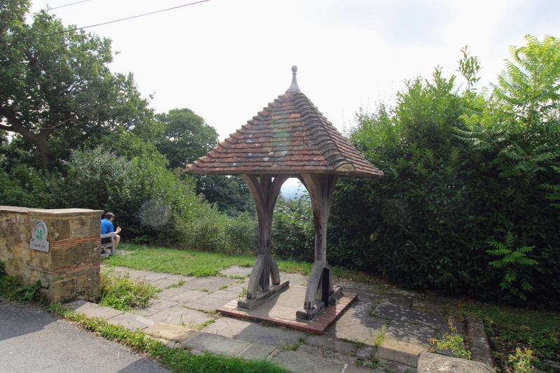
2. 1898. Pyramidal tiled roof on stout wood frame resting on single posts with quadrant braces. Pointed central arch. Bronze strip on beam above with inscription "Octavia Hill sank this well for the use of the villagers, 1898."
Listing NGR: TQ4689551168
External links are from the relevant listing authority and, where applicable, Wikidata. Wikidata IDs may be related buildings as well as this specific building. If you want to add or update a link, you will need to do so by editing the Wikidata entry.


Other nearby listed buildings