Latitude: 51.2019 / 51°12'6"N
Longitude: 1.1576 / 1°9'27"E
OS Eastings: 620685
OS Northings: 149478
OS Grid: TR206494
Mapcode National: GBR TZ4.RG8
Mapcode Global: VHLH2.01VZ
Plus Code: 9F336525+P3
Entry Name: The Red House
Listing Date: 29 September 1952
Grade: II
Source: Historic England
Source ID: 1085718
English Heritage Legacy ID: 170962
ID on this website: 101085718
Location: Derringstone, Canterbury, Kent, CT4
County: Kent
District: Canterbury
Civil Parish: Barham
Built-Up Area: Barham
Traditional County: Kent
Lieutenancy Area (Ceremonial County): Kent
Tagged with: House
1. 5273 BARHAM VALLEY ROAD (east side)
The Red Home TR 2049 25/91 29.9.52
II
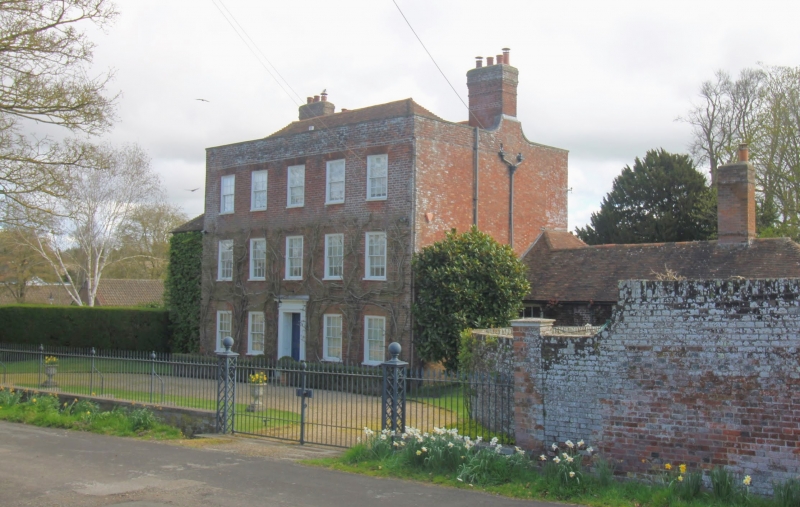
2. Large C18 home of 3 storeys in red brick with parapet and hipped tile roof with end stacks. Five windows, hung sashes with glazing bars. Doorway in moulded architrave surround with pilasters, projecting cornice over and door of 6 moulded panels. The interior has fireplaces taken from Nethersole House in the adjoining parish of Womenswold when this was demolished circa 1786.
Listing NGR: TR2068549478
External links are from the relevant listing authority and, where applicable, Wikidata. Wikidata IDs may be related buildings as well as this specific building. If you want to add or update a link, you will need to do so by editing the Wikidata entry.


Other nearby listed buildings