Latitude: 51.2543 / 51°15'15"N
Longitude: 1.0207 / 1°1'14"E
OS Eastings: 610882
OS Northings: 154907
OS Grid: TR108549
Mapcode National: GBR TYD.6X0
Mapcode Global: VHKK4.MQZT
Plus Code: 9F33723C+P7
Entry Name: Rattington House
Listing Date: 25 April 1977
Grade: II
Source: Historic England
Source ID: 1085692
English Heritage Legacy ID: 171103
ID on this website: 101085692
Location: Chartham, Canterbury, Kent, CT4
County: Kent
District: Canterbury
Civil Parish: Chartham
Built-Up Area: Shalmsford Street
Traditional County: Kent
Lieutenancy Area (Ceremonial County): Kent
Tagged with: House
1. 5273 CHARTHAM STOUR ROAD
Rattington House TR 1054 30/246 25.4.77
II GV
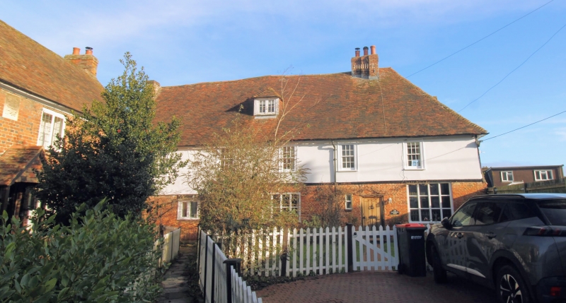
2. C16 or earlier timber-framed building with red brick infilling in the north-west wall but refronted facing south-west with red brick on the ground floor and plaster above. Two storeys and attics. Hipped tiled roof with one hipped dormer. Five windows in all. Sash windows with glazing bars intact to first floor. Casement windows on ground floor. Simple doorcases.
Listing NGR: TR1088254910
External links are from the relevant listing authority and, where applicable, Wikidata. Wikidata IDs may be related buildings as well as this specific building. If you want to add or update a link, you will need to do so by editing the Wikidata entry.


Other nearby listed buildings