Latitude: 51.3331 / 51°19'59"N
Longitude: 1.4228 / 1°25'22"E
OS Eastings: 638523
OS Northings: 164899
OS Grid: TR385648
Mapcode National: GBR X0M.6KD
Mapcode Global: VHMCW.MR1D
Plus Code: 9F338CMF+64
Entry Name: 20, Albion Place
Listing Date: 13 September 1974
Grade: II
Source: Historic England
Source ID: 1085419
English Heritage Legacy ID: 171668
ID on this website: 101085419
Location: Ramsgate, Thanet, Kent, CT11
County: Kent
District: Thanet
Civil Parish: Ramsgate
Built-Up Area: Ramsgate
Traditional County: Kent
Lieutenancy Area (Ceremonial County): Kent
Tagged with: Building
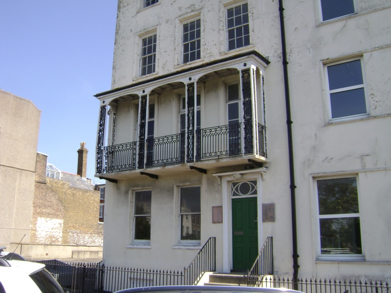
RAMSGATE ALBION PLACE TR 3864 NE (north-east side) 14/39 No. 20 13.9.74 GV II Terrace house, sometime municipal offices. Circa 1790. Rendered with slate roof. Four storeys and basement with parapet to roof. Two glazing bar sashes on 3rd floor and 3 on second floor all in moulded surrounds, with 3 French windows on 1st floor and tented verandah with geometric trellised piers and Gothick pattern rail panels. Three sashes on ground floor and single basement window. Entry originally by (blocked) doorway in left return. The building is now entered internally from the adjacent Council offices, which, although the structural core is of the same period, have been so defaced externally by conversion to municipal offices as to be no longer listable.
Listing NGR: TR3856064874
External links are from the relevant listing authority and, where applicable, Wikidata. Wikidata IDs may be related buildings as well as this specific building. If you want to add or update a link, you will need to do so by editing the Wikidata entry.


Other nearby listed buildings