Latitude: 51.0266 / 51°1'35"N
Longitude: 0.5631 / 0°33'47"E
OS Eastings: 579836
OS Northings: 128378
OS Grid: TQ798283
Mapcode National: GBR PV5.K5C
Mapcode Global: FRA D62D.M5P
Plus Code: 9F322HG7+M6
Entry Name: Clocktower Monument
Listing Date: 5 July 1993
Grade: II
Source: Historic England
Source ID: 1085161
English Heritage Legacy ID: 170357
ID on this website: 101085161
Location: Sandhurst, Tunbridge Wells, Kent, TN18
County: Kent
District: Tunbridge Wells
Civil Parish: Sandhurst
Built-Up Area: Sandhurst
Traditional County: Kent
Lieutenancy Area (Ceremonial County): Kent
Tagged with: Building
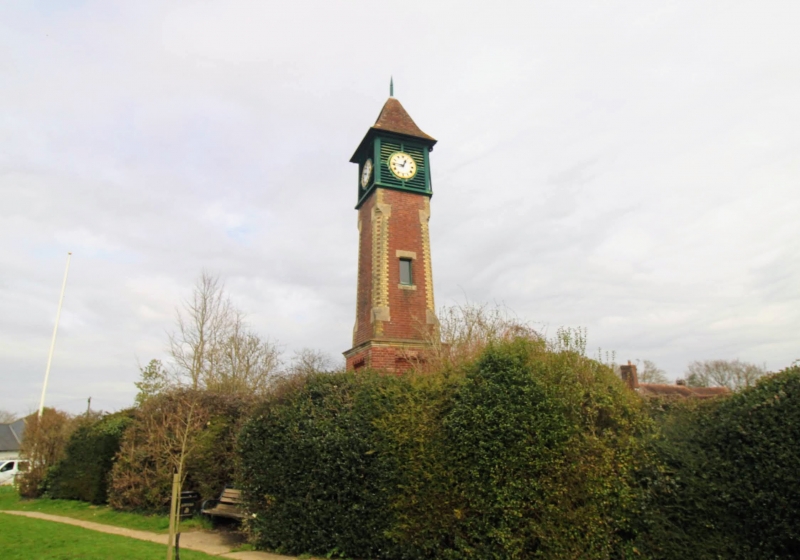
SANDHURST TQ7928 THE GREEN 1350-0/9/256 Clocktower Monument GV II Clocktower. Erected 1889 to the memory of Arthur Oakes Esq. J.P. by parishioners and friends. 3 stages. Lowest stage is square and of red brick with moulded stone cornice, panels to each face, corner piers and plinth. Tall second stage in red brick with chamfered corners pricked out in yellow brick. The top or bell stage is of wood, louvred, with metal clock faces and is surmounted by pyramidal roof with metal finial.
Listing NGR: TQ7983628378
External links are from the relevant listing authority and, where applicable, Wikidata. Wikidata IDs may be related buildings as well as this specific building. If you want to add or update a link, you will need to do so by editing the Wikidata entry.


Other nearby listed buildings