Latitude: 51.2146 / 51°12'52"N
Longitude: 1.153 / 1°9'10"E
OS Eastings: 620298
OS Northings: 150877
OS Grid: TR202508
Mapcode National: GBR TYY.Y02
Mapcode Global: VHLGV.XQWS
Plus Code: 9F336573+R5
Entry Name: Digges Place
Listing Date: 29 September 1952
Grade: II
Source: Historic England
Source ID: 1084894
English Heritage Legacy ID: 170928
ID on this website: 101084894
Location: Out Elmstead, Canterbury, Kent, CT4
County: Kent
District: Canterbury
Civil Parish: Barham
Traditional County: Kent
Lieutenancy Area (Ceremonial County): Kent
Tagged with: Building
1. 5273 BARHAM OUT ELMSTEAD LANE (north side)
Digges Place TR 2050 24/55 29.9.52
II GV
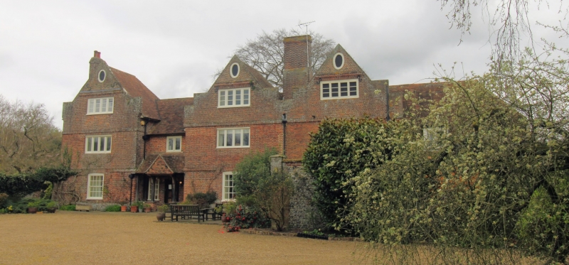
2. This house is called after the Digg or Diggs family which has a house on the site in the Middle Ages. The present building dates from the early C17. Three storeys and attics in red brick. Three gables with brick kneelers, the two to the right joined, that to the left attached with short lining section. Oval windows to attic storey. Brick cornices between all storeys. Second floor windows of four lights, as to 1st floor. Windows with hung sashes and glazing bars to ground floor. Modern door in tiled porch to set back link section, below 2-light window. Tile roofs.
Listing NGR: TR2029850877
External links are from the relevant listing authority and, where applicable, Wikidata. Wikidata IDs may be related buildings as well as this specific building. If you want to add or update a link, you will need to do so by editing the Wikidata entry.


Other nearby listed buildings