Latitude: 51.2019 / 51°12'6"N
Longitude: 1.1553 / 1°9'19"E
OS Eastings: 620522
OS Northings: 149470
OS Grid: TR205494
Mapcode National: GBR TZ4.QWF
Mapcode Global: VHLH1.Z13Z
Plus Code: 9F336524+P4
Entry Name: Cornerways
Listing Date: 14 March 1980
Last Amended: 8 February 1982
Grade: II
Source: Historic England
Source ID: 1084891
English Heritage Legacy ID: 170919
ID on this website: 101084891
Location: Derringstone, Canterbury, Kent, CT4
County: Kent
District: Canterbury
Civil Parish: Barham
Built-Up Area: Barham
Traditional County: Kent
Lieutenancy Area (Ceremonial County): Kent
Tagged with: Building
In the entry for BARHAM DERRINGSTONE STREET 25/41 (North side)
Cornerways
The address shall be amended to read RAILWAY HILL (North side) Cornerways
------------------------------------ In the entries for BARHAM DERRINGSTONE STREET (north side) 25/41 25/42 Cornerways 25/43 Farm Cottage Days Cottage
the street name shall be amded to read RAILWAY HILL
------------------------------------
1. 5273 BARHAM DERRINGSTONE STREET (north side)
Cornerways TR 2049 25/41
II GV
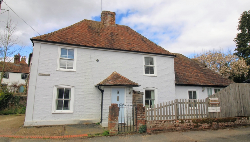
2. C18, possibly on earlier core. Two storeys in painted brick with hipped tile roof. Two windows, wood oases, above two with segmental beads, hung sashes. Modern porch. Sun fire plaque.
Listing NGR: TR2052249470
External links are from the relevant listing authority and, where applicable, Wikidata. Wikidata IDs may be related buildings as well as this specific building. If you want to add or update a link, you will need to do so by editing the Wikidata entry.


Other nearby listed buildings