Latitude: 51.1336 / 51°8'0"N
Longitude: 0.465 / 0°27'54"E
OS Eastings: 572561
OS Northings: 140036
OS Grid: TQ725400
Mapcode National: GBR PSP.Y31
Mapcode Global: VHJMZ.0RPV
Plus Code: 9F324FM8+C2
Entry Name: Monk's
Listing Date: 19 October 1970
Last Amended: 22 June 1989
Grade: II
Source: Historic England
Source ID: 1084684
English Heritage Legacy ID: 169572
ID on this website: 101084684
Location: Brandfold, Tunbridge Wells, Kent, TN17
County: Kent
District: Tunbridge Wells
Civil Parish: Goudhurst
Traditional County: Kent
Lieutenancy Area (Ceremonial County): Kent
Tagged with: Building
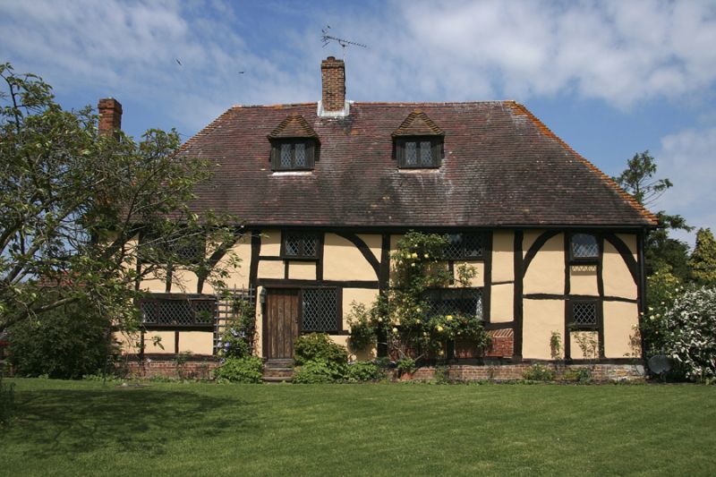
GOUDHURST MARDEN ROAD TQ 74 SW (west side) 1/222 Monk's (formerly 19.10.70 listed as Monk's Farm House) GV II House. Circa 1400. Timber framed and exposed large panel frame with plaster and some red brick infill and with plain tiled roof. Four framed bay end jettied hall house plan. Two storeys and attic on red brick plinth with jetty on brackets to end left, and with arched braces to eaves level. Hipped roof with stacks to centre left and projecting at end left, with 2 hipped dormers. Four leaded wooden casements on each floor, of 3, 2, 3 and 1 lights. Boarded door to centre left. Interior: four centred arched service doorways remain in cross-passage. Large scantling frame, with soot-blackened sans-purlin roof, each rafter-pair trussed by a collar. Inglenook fireplaces.
Listing NGR: TQ7256140036
External links are from the relevant listing authority and, where applicable, Wikidata. Wikidata IDs may be related buildings as well as this specific building. If you want to add or update a link, you will need to do so by editing the Wikidata entry.


Other nearby listed buildings