Latitude: 51.1136 / 51°6'49"N
Longitude: 0.46 / 0°27'35"E
OS Eastings: 572282
OS Northings: 137804
OS Grid: TQ722378
Mapcode National: GBR PT2.33X
Mapcode Global: VHJN4.X8JM
Plus Code: 9F324F75+FX
Entry Name: The Manor House with Projecting Wall
Listing Date: 20 June 1967
Grade: II
Source: Historic England
Source ID: 1084671
English Heritage Legacy ID: 169536
ID on this website: 101084671
Location: Goudhurst, Tunbridge Wells, Kent, TN17
County: Kent
District: Tunbridge Wells
Civil Parish: Goudhurst
Built-Up Area: Goudhurst
Traditional County: Kent
Lieutenancy Area (Ceremonial County): Kent
Tagged with: Building
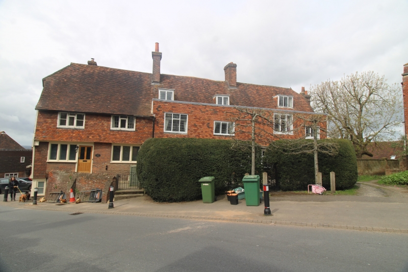
GOUDHURST HIGH STREET TQ 7237-7337 (north side) 15/186 The Manor House with 20.6.67 projecting wall GV II House. C16, altered C18 and restored late C20. Timber framed and partly exposed with plaster infill (and with restored and applied timbers), the first floor tile hung. Plain tiled roof. Two storeys and attic on plinth with continuous jetty on brackets and parapet to roof half-hipped to right, with stacks to left, to centre and projecting at end right. Three flat roofed leaded dormers. Four irregularly sized and placed leaded wooden and metal casements on 1st floor, that to centre right, with moulded cornice. Ground floor with 4 mullioned and transomed 3 light windows (inserted C20) and four centred-arched plank and stud doorway to centre left, also C20. Red brick wall to projecting at end left about 10 yards, about 3½ feet high, ramped up to house.
Listing NGR: TQ7228237804
External links are from the relevant listing authority and, where applicable, Wikidata. Wikidata IDs may be related buildings as well as this specific building. If you want to add or update a link, you will need to do so by editing the Wikidata entry.


Other nearby listed buildings