Latitude: 51.0399 / 51°2'23"N
Longitude: 0.5027 / 0°30'9"E
OS Eastings: 575554
OS Northings: 129712
OS Grid: TQ755297
Mapcode National: GBR PTX.MYB
Mapcode Global: FRA C6YC.FPW
Plus Code: 9F322GQ3+X3
Entry Name: The Rockery
Listing Date: 22 June 1989
Grade: II
Source: Historic England
Source ID: 1084573
English Heritage Legacy ID: 169798
ID on this website: 101084573
Location: The Moor, Tunbridge Wells, Kent, TN18
County: Kent
District: Tunbridge Wells
Civil Parish: Hawkhurst
Built-Up Area: Hawkhurst
Traditional County: Kent
Lieutenancy Area (Ceremonial County): Kent
Tagged with: Building
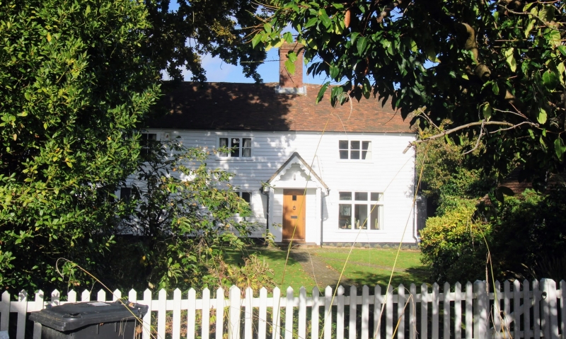
HAWKHURST TALBOT ROAD TQ 7429-7529 (west side) 18/447 The Rockery GV II House, sometime house pair. C18 exterior. Timber framed and weather-boarded with plain tiled roofs. Two parallel ranges. Two storeys and roof half-hipped to right with stacks to centre left, and projecting and offset at end left and at rear end left. Two storey canted bay to left with sashes, and sash and two 3-light wooden casements on first floor and 3-light wooden casement and mullioned and transomed casement to right on ground floor, with panelled door to centre left in gabled porch. Rear wing projects to end left.
Listing NGR: TQ7555229710
External links are from the relevant listing authority and, where applicable, Wikidata. Wikidata IDs may be related buildings as well as this specific building. If you want to add or update a link, you will need to do so by editing the Wikidata entry.


Other nearby listed buildings