Latitude: 53.9909 / 53°59'27"N
Longitude: -0.9148 / 0°54'53"W
OS Eastings: 471246
OS Northings: 455532
OS Grid: SE712555
Mapcode National: GBR QQ19.R3
Mapcode Global: WHFBZ.XYKC
Plus Code: 9C5XX3RP+93
Entry Name: Wesleyan Methodist Chapel
Listing Date: 14 April 1987
Grade: II
Source: Historic England
Source ID: 1083844
English Heritage Legacy ID: 167746
Also known as: Wesleyan Chapel, Stamford Bridge, East Riding of Yorkshire
ID on this website: 101083844
Location: Stamford Bridge, East Riding of Yorkshire, YO41
County: East Riding of Yorkshire
Civil Parish: Stamford Bridge
Built-Up Area: Stamford Bridge
Traditional County: Yorkshire
Lieutenancy Area (Ceremonial County): East Riding of Yorkshire
Church of England Parish: Stamford Bridge St John the Baptist
Church of England Diocese: York
Tagged with: Chapel
STAMFORD BRIDGE THE SQUARE 7155 (south side) 7/57 Wesleyan Methodist Chapel - II
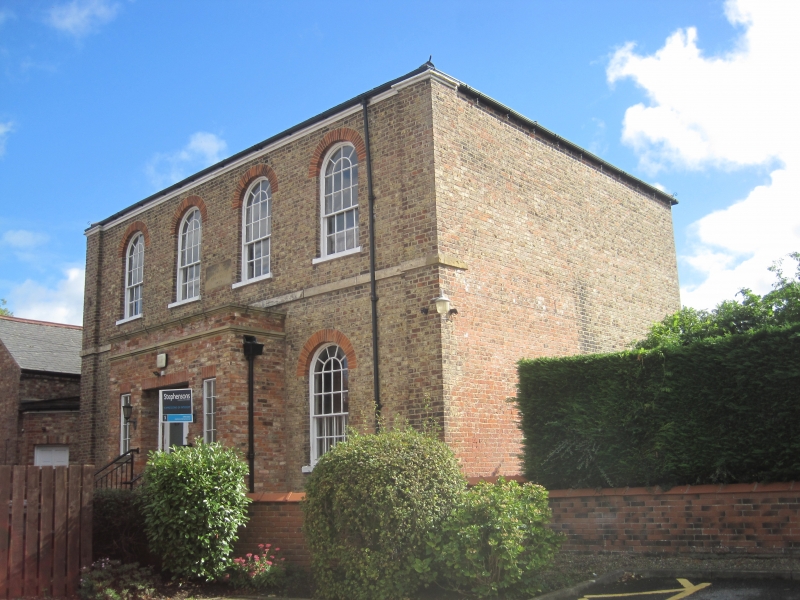
Chapel. 1828 on datestone over door; early C20 porch extension. Grey brick with stone dressings, timber eaves cornice, slate roof. 2 storeys, 4 bays. Ground floor: double-leaf doors with glazed panels flanked by slit windows to porch. 16-pane round-headed sashes with radial glazing and sills under round gauged brick arches to right and to left. First-floor band. First floor: 4 similar sashes. Clasping corner pilasters. Moulded timber eaves cornice, hipped roof.
Listing NGR: SE7124655532
External links are from the relevant listing authority and, where applicable, Wikidata. Wikidata IDs may be related buildings as well as this specific building. If you want to add or update a link, you will need to do so by editing the Wikidata entry.


Other nearby listed buildings