Latitude: 53.8501 / 53°51'0"N
Longitude: -0.9351 / 0°56'6"W
OS Eastings: 470152
OS Northings: 439848
OS Grid: SE701398
Mapcode National: GBR PRXX.CK
Mapcode Global: WHFCR.LHX8
Plus Code: 9C5XV327+3X
Entry Name: Church of St Mary
Listing Date: 16 December 1966
Grade: II
Source: Historic England
Source ID: 1083208
English Heritage Legacy ID: 165262
Also known as: St Mary's Church, Ellerton, East Riding of Yorkshire
ID on this website: 101083208
Location: St Mary's Church, Ellerton, East Riding of Yorkshire, YO42
County: East Riding of Yorkshire
Civil Parish: Ellerton
Built-Up Area: Ellerton
Traditional County: Yorkshire
Lieutenancy Area (Ceremonial County): East Riding of Yorkshire
Church of England Parish: Bubwith All Saints
Church of England Diocese: York
Tagged with: Church building
ELLERTON MAIN STREET SE 73 NW (west end) 3/37 Church of St Mary 16.12.66
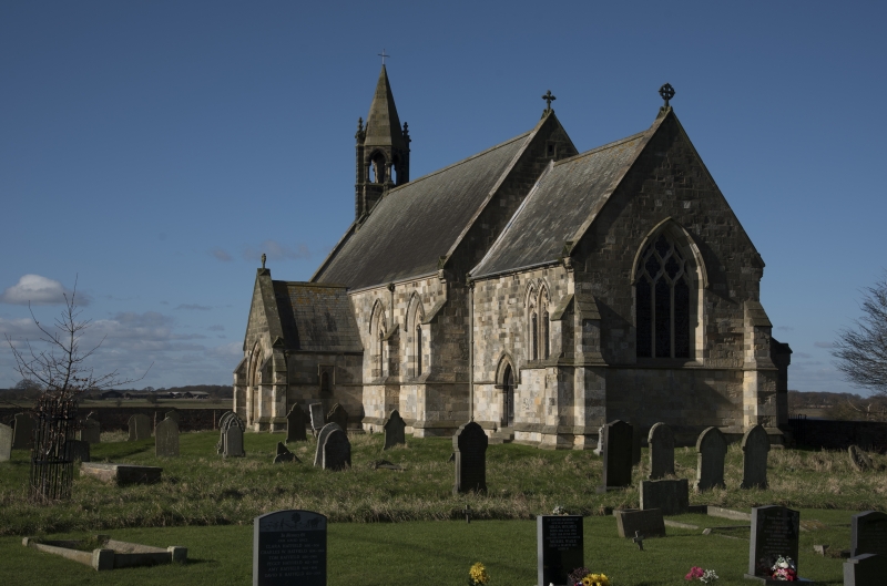
- II Church. 1846-8. By J L Pearson. Ashlar and Westmorland slate roof. 4-bay nave with west bellcote and gabled south porch, and single-bay chancel with vestry to north. In Decorated style. Chamfered plinth and continuous chamfered sill string course. West end: central stepped buttress flanked by traceried lancets on continuous angled string course, with diagonal buttresses to angles. Diamond set square 2-light bellcote with pointed openings on round shafts with pyramidal stone roof. Nave: pointed doorway on octagonal responds flanked by angle buttresses to porch. Pointed 2-light windows with quatrefoil and mouchette tracery flanked by stepped buttresses. Chancel: pointed priest's door with paired traceried lancets to right to south side. Vestry has paired lancets to east. Paired traceried lancets to east bay of north wall of chancel. East elevation: pointed 3-light window with reticulated tracery. All openings below hoodmoulds and all gables with stone copings on gableted kneelers. Ridge crosses to east gables. Derelict at time of resurvey and interior not inspected.
Listing NGR: SE7015239848
External links are from the relevant listing authority and, where applicable, Wikidata. Wikidata IDs may be related buildings as well as this specific building. If you want to add or update a link, you will need to do so by editing the Wikidata entry.


Other nearby listed buildings