Latitude: 52.1621 / 52°9'43"N
Longitude: -2.8796 / 2°52'46"W
OS Eastings: 339929
OS Northings: 251896
OS Grid: SO399518
Mapcode National: GBR FC.5VQV
Mapcode Global: VH77K.1XJF
Plus Code: 9C4V546C+R5
Entry Name: The Cwm
Listing Date: 20 February 1953
Grade: II
Source: Historic England
Source ID: 1081865
English Heritage Legacy ID: 149941
ID on this website: 101081865
Location: Weobley, County of Herefordshire, HR4
County: County of Herefordshire
Civil Parish: Weobley
Built-Up Area: Weobley
Traditional County: Herefordshire
Lieutenancy Area (Ceremonial County): Herefordshire
Church of England Parish: Weobley
Church of England Diocese: Hereford
Tagged with: Building
SO 35 SE WEOBLEY CP MEADOW STREET (sourh side) 6/159 The Cwm
20.2.53
GV II
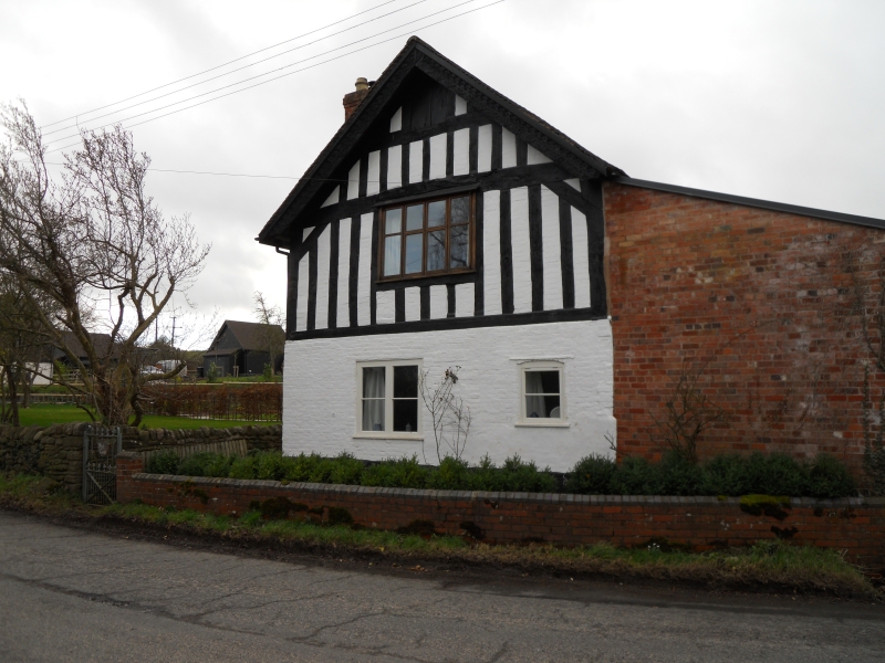
House. Probably C15, with mid-C18 and mid-C19 alterations. Timber-frame with painted brick and rendered infill, partly rebuilt in painted brick under a tile roof. Three framed bays aligned east/west, lateral stack on south wall of rubble with a brick shaft. East front of two storeys, gabled, and formerly jettied. A 4-light window to first floor has a plank weathering. Ground floor has a 2-light casement to left and a single-light casement to right with a plank weathering. Entrance in south wall. Framing: close-studded to first floor with short angle braces. Gable truss has a collar and is also close-studded. The bargeboards are C15 with traceried decoration. Possibly the cross-wing of a larger house. (RCHM, 3, pp 197-8; no 15).
Listing NGR: SO3992951896
External links are from the relevant listing authority and, where applicable, Wikidata. Wikidata IDs may be related buildings as well as this specific building. If you want to add or update a link, you will need to do so by editing the Wikidata entry.


Other nearby listed buildings