Latitude: 52.3056 / 52°18'20"N
Longitude: -2.7391 / 2°44'20"W
OS Eastings: 349703
OS Northings: 267758
OS Grid: SO497677
Mapcode National: GBR BK.WSFF
Mapcode Global: VH84H.G9TV
Plus Code: 9C4V8746+79
Entry Name: Comberton Farmhouse
Listing Date: 11 June 1959
Grade: II
Source: Historic England
Source ID: 1081813
English Heritage Legacy ID: 150115
ID on this website: 101081813
Location: Comberton, County of Herefordshire, SY8
County: County of Herefordshire
Civil Parish: Orleton
Traditional County: Herefordshire
Lieutenancy Area (Ceremonial County): Herefordshire
Church of England Parish: Orleton
Church of England Diocese: Hereford
Tagged with: Farmhouse
ORLETON CP COMBERTON SO 4967 10/93 Comberton Farmhouse 11.6.59 GV II
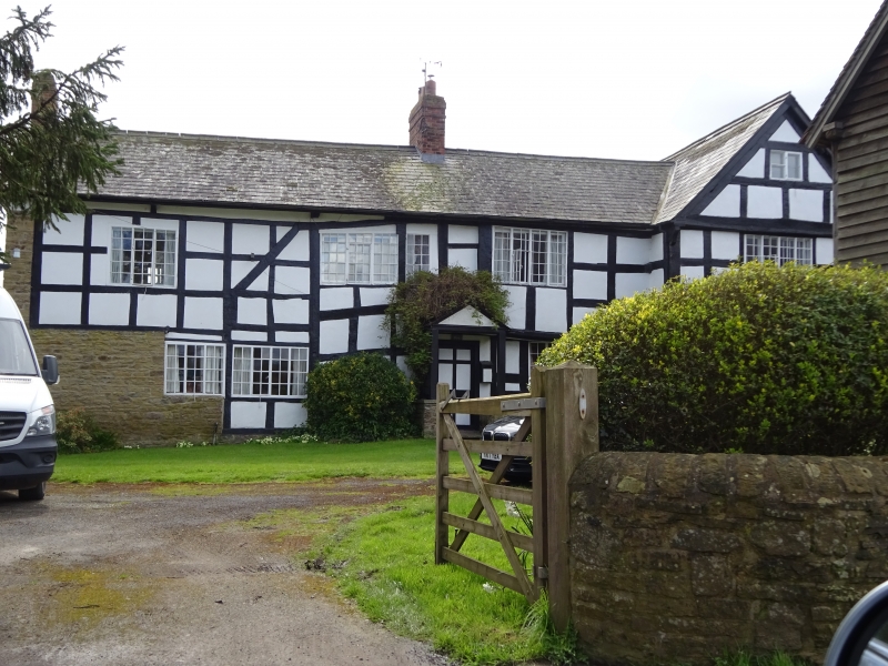
Farmhouse. Late C16 to early C17, remodelled late C18 with some 1980's restoration. Timber-frame with rendered infill and slate roof. L-plan, cross-wing extending to south, other range slightly offset extending to east. Lobby entrance against stack in middle of east range. North front of two storeys with gable-lit attic to cross-wing on right. First floor four plus one windows, two 3-light casements to left, a fixed casement and two 4-light casements. Ground floor has three plus one windows, the outer two are 3-light casements, the others 4-light casements. The cross- wing jetty is underbuilt in rubble, whilst the bay nearest this end of the other range is jettied on scroll brackets. Entrance to right of centre in subsidiary range with a shallow-pitched gabled slated canopy of plain wooden posts with a 6-panel door. Framing: five square panels high, cross-wing gable has a slightly projecting tie-beam with two collars and vertical struts. Interior of cross-wing has traces of floral wall-paintings in the north room on the first floor. Several triangular doorheads and exposed chamfered and stopped-ceiling beams. (RCHM, 3, p 159, no 27).
Listing NGR: SO4970367758
External links are from the relevant listing authority and, where applicable, Wikidata. Wikidata IDs may be related buildings as well as this specific building. If you want to add or update a link, you will need to do so by editing the Wikidata entry.


Other nearby listed buildings