Latitude: 52.2792 / 52°16'45"N
Longitude: -2.7786 / 2°46'43"W
OS Eastings: 346974
OS Northings: 264844
OS Grid: SO469648
Mapcode National: GBR BH.YGMH
Mapcode Global: VH770.SZD5
Plus Code: 9C4V76HC+MG
Entry Name: Tower About 15 Metres South of Church of St Leonard
Listing Date: 11 December 1987
Grade: I
Source: Historic England
Source ID: 1081790
English Heritage Legacy ID: 150166
ID on this website: 101081790
Location: St Leonard's Church, Yarpole, County of Herefordshire, HR6
County: County of Herefordshire
Civil Parish: Croft and Yarpole
Built-Up Area: Yarpole
Traditional County: Herefordshire
Lieutenancy Area (Ceremonial County): Herefordshire
Church of England Parish: Croft with Yarpole and Lucton
Church of England Diocese: Hereford
Tagged with: Tower
YARPOLE CP GREEN LANE (north side) SO 46 SE 6/143 Tower about 15 metres south of Church of St Leonard GV I
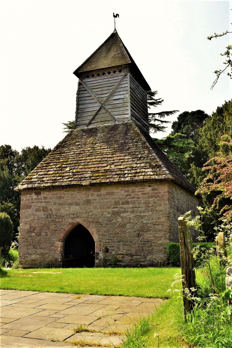
Detached tower. Probably C13, restored 1910. Random rubble with some ashlar dressings and stone tile and shingle roof. Square plan walls on ground floor enclosing frame of tower, lean-to roofs on stone walls, upper part of tower weatherboarded with range of seven pierced quatrefoils just below the pyramidal roof. The entrance in north wall has a chamfered segmental pointed arch. The boarded door has plain strap hinges. Simple slit windows in the other walls. Interior: whole tower supported on four massive corner posts which are inclined inwards and taper towards the top. The sides between posts are scissor-braced. Empty mortices in the main posts suggest that the outer wall may have been timber-framed. The early C20 restorers bolted new braces onto the inside of the frame. (RCHM, 3, p 215; BoE, p 327).
Listing NGR: SO4697464844
External links are from the relevant listing authority and, where applicable, Wikidata. Wikidata IDs may be related buildings as well as this specific building. If you want to add or update a link, you will need to do so by editing the Wikidata entry.


Other nearby listed buildings