Latitude: 52.3186 / 52°19'6"N
Longitude: -2.524 / 2°31'26"W
OS Eastings: 364376
OS Northings: 269070
OS Grid: SO643690
Mapcode National: GBR BT.W5B5
Mapcode Global: VH84F.6ZHG
Plus Code: 9C4V8F9G+C9
Entry Name: The White House
Listing Date: 27 February 1986
Grade: II
Source: Historic England
Source ID: 1081427
English Heritage Legacy ID: 149298
ID on this website: 101081427
Location: Newnham Bridge, Malvern Hills, Worcestershire, WR15
County: Worcestershire
District: Malvern Hills
Civil Parish: Knighton on Teme
Traditional County: Worcestershire
Lieutenancy Area (Ceremonial County): Worcestershire
Church of England Parish: Teme Valley North
Church of England Diocese: Worcester
Tagged with: House
KNIGHTON ON TEME CP NEWNHAM BRIDGE SO 66 NW
4/105 The White House
- II
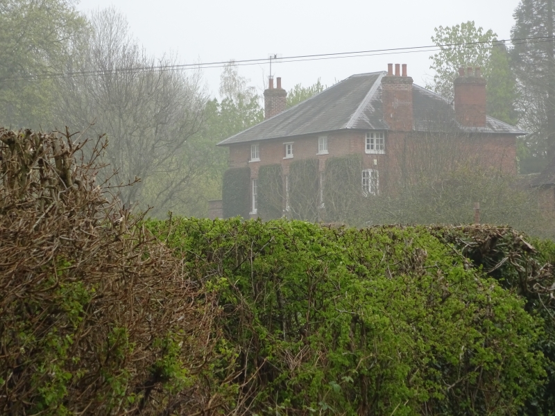
House. c1800 with late C20 alterations. Brick, Welsh slate hipped roof with broad eaves and large stacks at each side. Three storeys and cellar. Three bays; ground and first floor windows have cambered heads and are 12- pane sashes; second floor windows are 2-light casements; central entrance has a moulded and gabled canopy on shaped brackets, fluted pilasters and double doors each with two lower raised and fielded panels and an upper glazed panel; panelled soffit and reveals. C20 lean-to addition to right side elevation.
Listing NGR: SO6437669070
External links are from the relevant listing authority and, where applicable, Wikidata. Wikidata IDs may be related buildings as well as this specific building. If you want to add or update a link, you will need to do so by editing the Wikidata entry.


Other nearby listed buildings