Latitude: 52.2697 / 52°16'10"N
Longitude: -2.0792 / 2°4'45"W
OS Eastings: 394692
OS Northings: 263505
OS Grid: SO946635
Mapcode National: GBR 2GP.P4X
Mapcode Global: VH92H.X65X
Plus Code: 9C4V7W9C+V8
Entry Name: The Moorlands
Listing Date: 29 December 1952
Grade: II
Source: Historic England
Source ID: 1081240
English Heritage Legacy ID: 147820
ID on this website: 101081240
Location: Wychavon, Worcestershire, WR9
County: Worcestershire
District: Wychavon
Civil Parish: Hanbury
Traditional County: Worcestershire
Lieutenancy Area (Ceremonial County): Worcestershire
Church of England Parish: Hanbury
Church of England Diocese: Worcester
Tagged with: Building
HANBURY CP SCHOOL ROAD (south side) SO 96 SW 3/144 (11/3) The Moorlands 29.12.52 - II
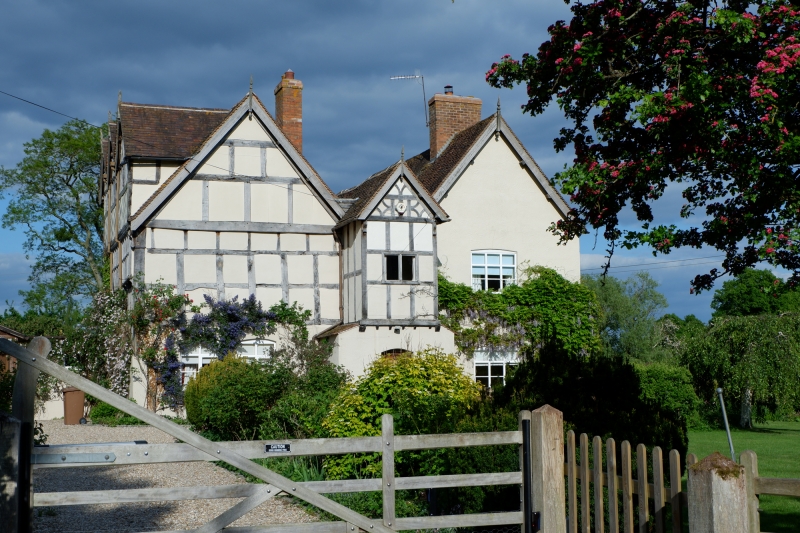
Farmhouse, now house. Dated 1615, remodelled c1880, altered mid-C20. Part timber-framed with rendered infill and brick replacement walling, part rendered brick; plain tiled roof with two C19 brick stacks. Square plan of parallel three-bay ranges aligned east/west; the northernmost range is the surviving C17 solar of an earlier house replaced by the southernmost range in the C19; a small porch wing was added at the centre of the new west entrance elevation. Two storeys, cellar and attic; the attic storey of the C17 part has a row of three gables facing north with moulded bargeboards and finials; the C19 part has a dentilled eaves cornice. Framing: the north elevation has upper floors slightly jettied on moulded bressummers; the first floor has a row of close- set vertical studs and the attic gables have herringbone panels beneath the fenestration, and each gable has a collar and tie-beam truss with two struts and decorative infill panels. The west gable end has two main rows and an additional smaller row of panels at first-floor level, and a collar and tie- beam truss with two collars, three struts to the lower and two to the upper collar. West front elevation: C17 gable end has two ground-floor cross- casements; C19 gable end has a 3-light ground- and first-floor casement; all windows have cambered heads. The central gabled two-storey porch has an off- set ground floor and a timber-framed first floor with decorative framing in the gable, moulded bargeboards and finial; the C20 door and 2-light casements in each side elevation of the ground floor have cambered heads; there is a first floor 2-light casement. The north elevation has three 5-light C20 mullioned and transomed windows on the first floor, and three similar mullioned windows to the attic gables providing a continuous gallery on both storeys. In the south gable is the date "1615". Interior: the timber-frame of the gables has been partly replaced. In the west bay of the C17 part is a large fireplace. The house belonged to the Vernon Estate. The surviving timber-framed part would imply that it was originally a house of considerable local importance. (VCH 3 (ii), p 372).
Listing NGR: SO9469263505
External links are from the relevant listing authority and, where applicable, Wikidata. Wikidata IDs may be related buildings as well as this specific building. If you want to add or update a link, you will need to do so by editing the Wikidata entry.


Other nearby listed buildings