Latitude: 52.2714 / 52°16'16"N
Longitude: -2.2308 / 2°13'50"W
OS Eastings: 384346
OS Northings: 263714
OS Grid: SO843637
Mapcode National: GBR 1F5.DV8
Mapcode Global: VH92F.950M
Plus Code: 9C4V7QC9+GM
Entry Name: Styles Farmhouse
Listing Date: 21 March 1985
Grade: II
Source: Historic England
Source ID: 1081177
English Heritage Legacy ID: 147973
ID on this website: 101081177
Location: Ombersley, Wychavon, Worcestershire, WR9
County: Worcestershire
District: Wychavon
Civil Parish: Ombersley
Built-Up Area: Ombersley
Traditional County: Worcestershire
Lieutenancy Area (Ceremonial County): Worcestershire
Church of England Parish: Ombersley
Church of England Diocese: Worcester
Tagged with: Farmhouse
SO 8463 OMBERSLEY CP APPLE TREE WALK
9/78 Styles Farmhouse
-
- II
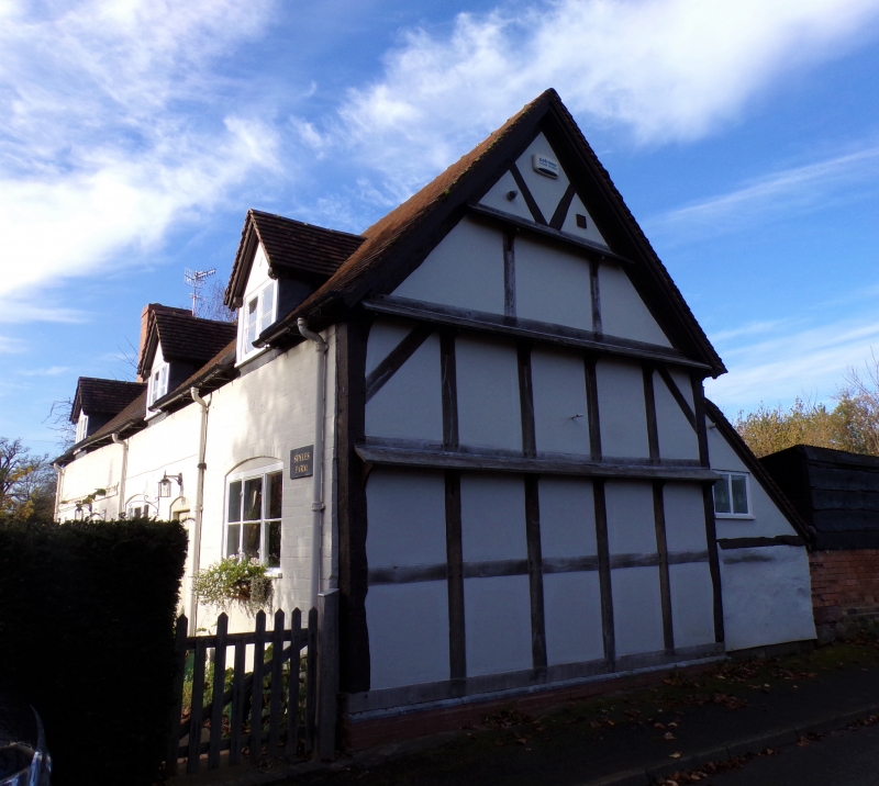
Farmhouse, now house. C17 with mid-C19 alterations and additions. Part timber-framed with painted brick infill, brick replacement walling and refacing, part dressed sandstone, plain tiled roof, star-shaped stack to main ridge and exernal brick stacks at gable ends. Probably four framed bays; single storey and attic with dormers; decorative cogged brick course between storeys to left of front elevation. Framing: exposed in right gable end; three square panels from sill to wall-plate, short straight braces in upper corners; both gable ends have collar-and-tie-beam trusses with queen struts exposed. Front elevation: one 2-light casement; two 3-light casements with cambered heads, three gabled dormers with 3-light casements; between ground floor 3-light casements is a part-glazed door with a cambered head; also additional ledged and battened door in left bay. Interior not inspected. A single storey wing adjoins left gable end; also rear outshuts.
Listing NGR: SO8434663714
External links are from the relevant listing authority and, where applicable, Wikidata. Wikidata IDs may be related buildings as well as this specific building. If you want to add or update a link, you will need to do so by editing the Wikidata entry.


Other nearby listed buildings