Latitude: 51.5766 / 51°34'35"N
Longitude: 0.02 / 0°1'12"E
OS Eastings: 540072
OS Northings: 188348
OS Grid: TQ400883
Mapcode National: GBR LP.9QR
Mapcode Global: VHHN4.9MFR
Plus Code: 9F32H2GC+J2
Entry Name: 56, New Wanstead
Listing Date: 22 February 1979
Grade: II
Source: Historic England
Source ID: 1081007
English Heritage Legacy ID: 204861
ID on this website: 101081007
Location: Wanstead, Redbridge, London, E11
County: London
District: Redbridge
Electoral Ward/Division: Snaresbrook
Parish: Non Civil Parish
Built-Up Area: Redbridge
Traditional County: Essex
Lieutenancy Area (Ceremonial County): Greater London
Church of England Parish: Wanstead St Mary with Christ Church
Church of England Diocese: Chelmsford
Tagged with: Building
This list entry was subject to a Minor Amendment on 5 December 2024 to reformat the text to current standards
TQ 4088
14/10
NEW WANSTEAD E11
No 56
II
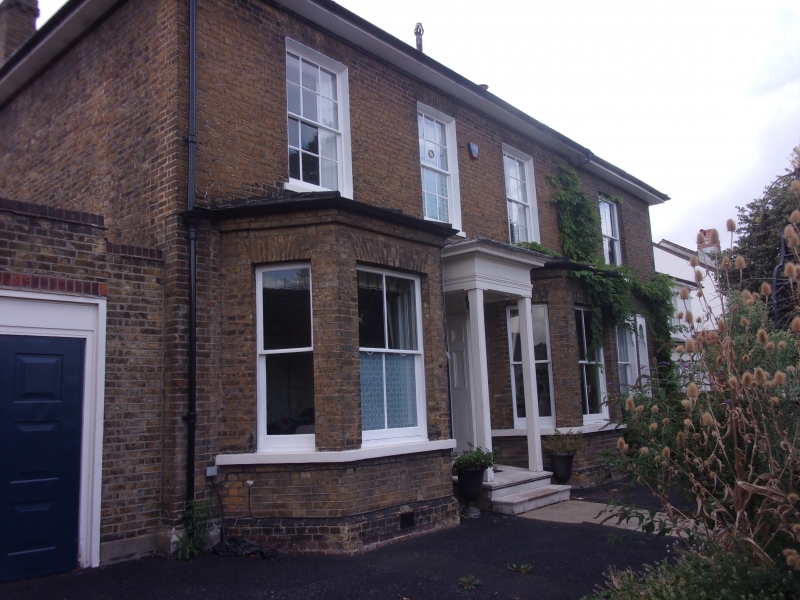
Probably mid C19. Detached house. Two-storeys. Three windows wide. Yellow stock brick. Low pitch hipped slate roof. Central entrance flanked by canted bay windows. Porchwith fluted Doric columns. Upper windows recessed sashes, under flat gauged arches, with glazing bars. Side extension of slightly later date.
Listing NGR: TQ4007288348
External links are from the relevant listing authority and, where applicable, Wikidata. Wikidata IDs may be related buildings as well as this specific building. If you want to add or update a link, you will need to do so by editing the Wikidata entry.


Other nearby listed buildings