Latitude: 51.5809 / 51°34'51"N
Longitude: 0.1779 / 0°10'40"E
OS Eastings: 551001
OS Northings: 189142
OS Grid: TQ510891
Mapcode National: GBR SK.1JT
Mapcode Global: VHHN7.1JFF
Plus Code: 9F32H5JH+95
Entry Name: Bms Insurance
Listing Date: 14 September 1979
Grade: II
Source: Historic England
Source ID: 1079909
English Heritage Legacy ID: 201625
ID on this website: 101079909
Location: Romford, Havering, London, RM1
County: London
District: Havering
Electoral Ward/Division: Brooklands
Parish: Non Civil Parish
Built-Up Area: Havering
Traditional County: Essex
Lieutenancy Area (Ceremonial County): Greater London
Church of England Parish: Romford St Edward Confessor
Church of England Diocese: Chelmsford
Tagged with: Building
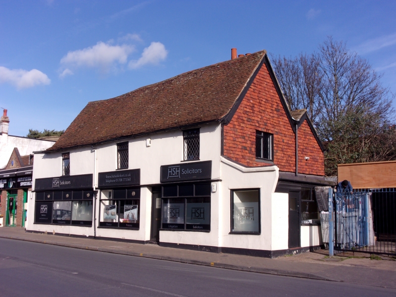
NORTH STREET 1. 5107 Romford Nos 96 to 102 (even) (B.M.S. Insurance) TQ 58 NW 10/2 II 2. Late C17 timber-framed building consisting of 2 parallel ranges, that in front taller than the one behind. Two storeys, rendered, altered ground floor with modern shop fronts. Three modern windows to 1st floor. South end wall tile hung, rear wall rendered. Rebuilt stack in valley at south.
Listing NGR: TQ5100189142
External links are from the relevant listing authority and, where applicable, Wikidata. Wikidata IDs may be related buildings as well as this specific building. If you want to add or update a link, you will need to do so by editing the Wikidata entry.


Other nearby listed buildings