Latitude: 52.0498 / 52°2'59"N
Longitude: -1.7833 / 1°46'59"W
OS Eastings: 414955
OS Northings: 239072
OS Grid: SP149390
Mapcode National: GBR 4NF.KXW
Mapcode Global: VHB13.1QLY
Plus Code: 9C4W26X8+WM
Entry Name: Wireless Supply
Listing Date: 8 June 1983
Grade: II
Source: Historic England
Source ID: 1078441
English Heritage Legacy ID: 126175
ID on this website: 101078441
Location: Chipping Campden, Cotswold, Gloucestershire, GL55
County: Gloucestershire
District: Cotswold
Civil Parish: Chipping Campden
Built-Up Area: Chipping Campden
Traditional County: Gloucestershire
Lieutenancy Area (Ceremonial County): Gloucestershire
Church of England Parish: Chipping Campden St James
Church of England Diocese: Gloucester
Tagged with: Building
1. 5224 HIGH STREET (north-west side)
Wireless supply SP 1439 SE 9/124
II GV
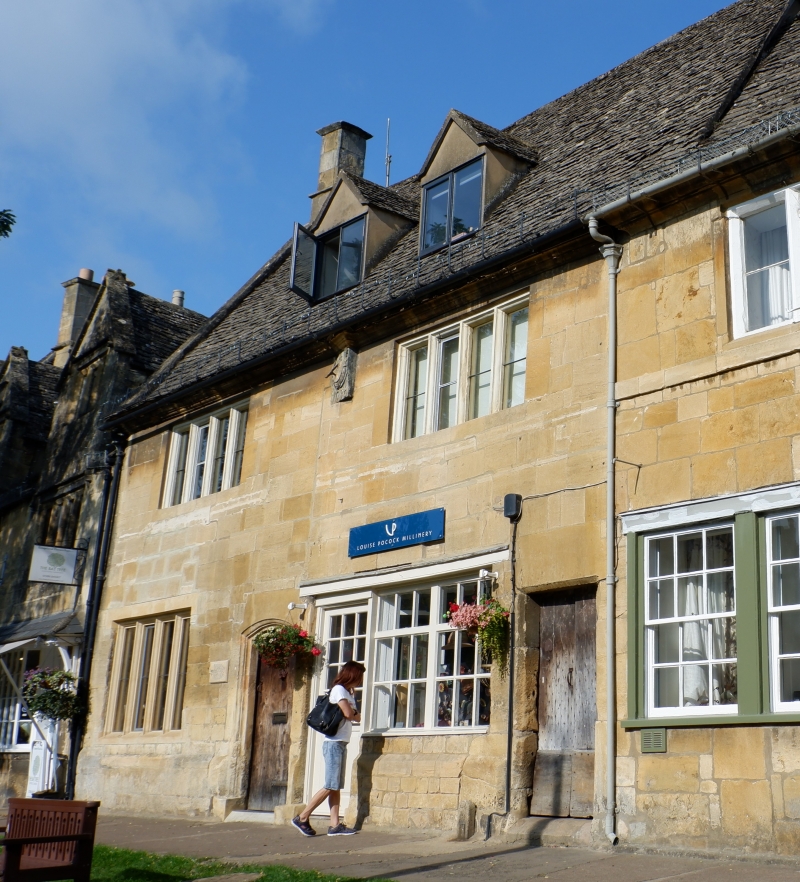
2. Mid C19 remodelling. Low 3 storey house in coursed and squared rubble. Three windows, 2 light casements, some retaining leaded panes. On ground floor 2 glazing bar angled bay shop windows, right hand one wider, and outer doorways (right hand one to alley). Slate roof.
Listing NGR: SP1495739069
External links are from the relevant listing authority and, where applicable, Wikidata. Wikidata IDs may be related buildings as well as this specific building. If you want to add or update a link, you will need to do so by editing the Wikidata entry.


Other nearby listed buildings