Latitude: 52.4939 / 52°29'38"N
Longitude: -1.9474 / 1°56'50"W
OS Eastings: 403668
OS Northings: 288446
OS Grid: SP036884
Mapcode National: GBR 5N3.WW
Mapcode Global: VH9YW.6LB0
Plus Code: 9C4WF3V3+H2
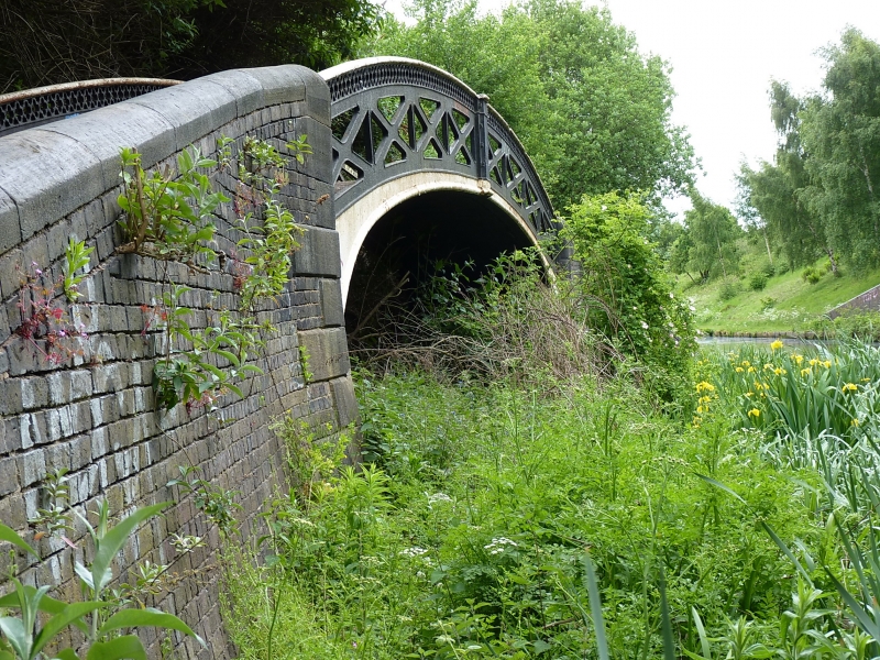
Entry Name: Towpath Bridge at SP 036 884 (Approximately 640 Metres South East of Radbone Lane) Birmingham Canal Birmingham Level
Listing Date: 29 September 1987
Grade: II
Source: Historic England
Source ID: 1077155
English Heritage Legacy ID: 219219
ID on this website: 101077155
Location: Merry Hill, Sandwell, West Midlands, B66
County: Sandwell
Electoral Ward/Division: Soho and Victoria
Parish: Non Civil Parish
Built-Up Area: Smethwick
Traditional County: Staffordshire
Lieutenancy Area (Ceremonial County): West Midlands
Church of England Parish: Smethwick St Matthew with St Chad
Church of England Diocese: Birmingham
SANDWELL MB BIRMINGHAM CANAL SP 08 NW Birmingham Level, Smethwick 9/17 Towpath bridge at SP 036 884 (approx 640m south-east of Radbone Lane)
II
Bridge carrying northern towpath of Birmingham Canal over dis-used branch. Dates from widening of canal in 1827. Cast-iron. Brick abutments have stone dressings. Single elliptical arch. Sides each of two castings, bolted to central "keystone". Pierced in form of saltire crosses, with band of quatrefoils below handrail. Illegible inscription in south-west spandrel.
Listing NGR: SP0366888446
External links are from the relevant listing authority and, where applicable, Wikidata. Wikidata IDs may be related buildings as well as this specific building. If you want to add or update a link, you will need to do so by editing the Wikidata entry.


Other nearby listed buildings