Latitude: 52.5725 / 52°34'21"N
Longitude: 0.8334 / 0°50'0"E
OS Eastings: 592102
OS Northings: 300960
OS Grid: TF921009
Mapcode National: GBR RBF.MJ1
Mapcode Global: WHKRB.SL1P
Plus Code: 9F42HRFM+28
Entry Name: Gates and Gatepier at east end of Church Walk
Listing Date: 31 August 1983
Grade: II
Source: Historic England
Source ID: 1076812
English Heritage Legacy ID: 220126
ID on this website: 101076812
Location: Watton, Breckland, Norfolk, IP25
County: Norfolk
District: Breckland
Civil Parish: Watton
Built-Up Area: Watton
Traditional County: Norfolk
Lieutenancy Area (Ceremonial County): Norfolk
Church of England Parish: Watton St Mary
Church of England Diocese: Norwich
Tagged with: Gate
This list entry was subjected to a Minor Enhancement 25 September 2024 to update details and reformat the text to current standards
TF 90 SW
1/88
WATTON
CHURCH WALK
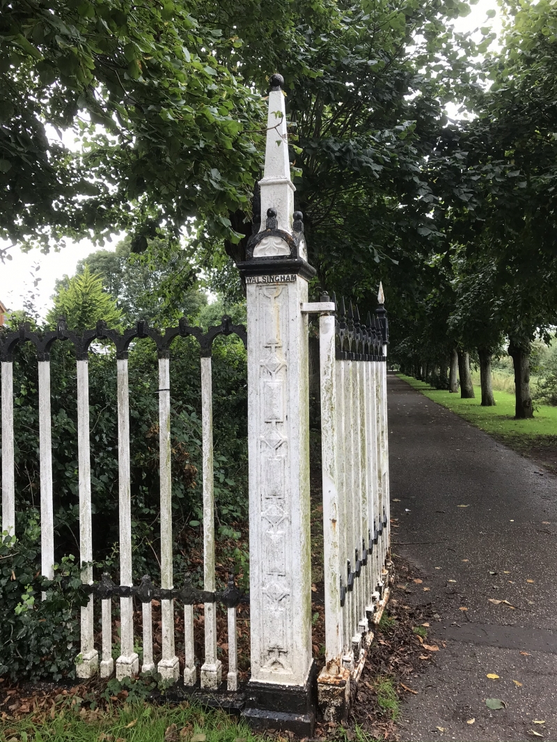
Gates and Gatepier at east end of Church Walk
GV
II
Gates, gate piers and fence originally erected in 1902. Cast iron. Gate piers square with raised and fielded rectangular and diamond studs below cornice plate inscribed 'Walsingham' (left pier) and '1902' (right pier). Square ball and steeple finial buttressed by four small similar crockets stands on semi-circular decorated squinches. Fence to left and right of arcaded square section verticals with bottom rail and surmounted by small ball finials. Gates of similar design made in 1999 and rehung in 2002, replacing the originals.
Listing NGR: TF9210200960
External links are from the relevant listing authority and, where applicable, Wikidata. Wikidata IDs may be related buildings as well as this specific building. If you want to add or update a link, you will need to do so by editing the Wikidata entry.


Other nearby listed buildings