Latitude: 52.4714 / 52°28'17"N
Longitude: -1.9474 / 1°56'50"W
OS Eastings: 403669
OS Northings: 285944
OS Grid: SP036859
Mapcode National: GBR 5NC.WY
Mapcode Global: VH9Z2.64BR
Plus Code: 9C4WF3C3+H2
Entry Name: St Gilbert's
Listing Date: 8 July 1982
Grade: II
Source: Historic England
Source ID: 1076344
English Heritage Legacy ID: 217200
ID on this website: 101076344
Location: Birmingham, West Midlands, B16
County: Birmingham
Parish: Non Civil Parish
Built-Up Area: Birmingham
Traditional County: Warwickshire
Lieutenancy Area (Ceremonial County): West Midlands
Church of England Parish: Edgbaston St Augustine
Church of England Diocese: Birmingham
Tagged with: Building
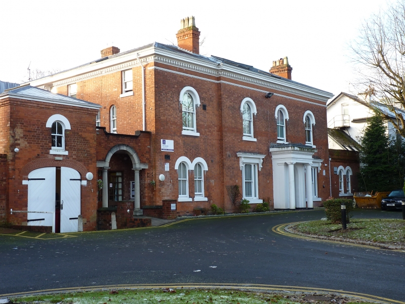
HAGLEY ROAD 1. 5104 (south side) Edgbaston B16 No 212 (St Gilbert's) SP 08 NW 6/21 II GV 2. Mid C19. Brick; slate roof. Two storeys; 3 bays plus a fourth on the left a little recessed. Ground floor with central entrance within a closed porch with arched opening and flanking piers and Tuscan columns supporting an entablature and 2 tripartite windows with arched lights and cornices on brackets. First floor with 3 arched windows. Dentilled and moulded eaves cornice. The recessed bay with ground floor coupled arched windows and a first floor window as the others. All the windows sashes with glazing bars. Moulded and dentilled eaves cornice. To the left of this, a link wall with subsidiary arches, entrance and then the 2 storeyed coach house with broad segmental arched opening and a small arched window above. To the right, a single storeyed extension with coupled arched windows.
Listing NGR: SP0366985944
External links are from the relevant listing authority and, where applicable, Wikidata. Wikidata IDs may be related buildings as well as this specific building. If you want to add or update a link, you will need to do so by editing the Wikidata entry.


Other nearby listed buildings