Latitude: 52.4936 / 52°29'36"N
Longitude: -1.914 / 1°54'50"W
OS Eastings: 405937
OS Northings: 288412
OS Grid: SP059884
Mapcode National: GBR 5X4.80
Mapcode Global: VH9YW.SL08
Plus Code: 9C4WF3VP+CC
Entry Name: Albion Place
Listing Date: 8 July 1982
Grade: II
Source: Historic England
Source ID: 1076301
English Heritage Legacy ID: 217298
ID on this website: 101076301
Location: Hockley, Birmingham, West Midlands, B18
County: Birmingham
Parish: Non Civil Parish
Built-Up Area: Birmingham
Traditional County: Warwickshire
Lieutenancy Area (Ceremonial County): West Midlands
Church of England Parish: Birmingham Bishop Latimer with All Saints
Church of England Diocese: Birmingham
Tagged with: Building
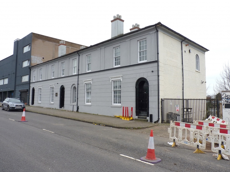
HOCKLEY HILL 1. 5104 Hockley B18 Nos 51 to 54 (consec) (Albion Place) SP 08 NE 7/57 II 2. Circa 1830 symmetrical terrace originally of four 2 storey stucco faced houses of 2 bays. Chanelled ground floor up to first floor sill course. First floor articulated by short panelled pilasters, coupled between bays 2 and 3 and 6 and 7. The shallow capitals carry frieze, moulded flat eaves to common hipped slate roof. Flanking stucco chimney stacks on front pitch. Revealed glazing bar sashes, 4 x 5 panes on ground floor, 3 x 4 panes on first floor. Those on ground floor have incised panelled heads flanked by consoles with thin cornices over. The chanelling is struck into round headed doorways with panelled architraves in antis, impost blocks, moulded doorheads returned to panelled reveals. Six panel doors, inverted, radial looped, marginal glazing pattern to fanlights. Originally 2 doorways to centre, one was adapted as window.
Listing NGR: SP0593788412
External links are from the relevant listing authority and, where applicable, Wikidata. Wikidata IDs may be related buildings as well as this specific building. If you want to add or update a link, you will need to do so by editing the Wikidata entry.


Other nearby listed buildings