Latitude: 52.4068 / 52°24'24"N
Longitude: -1.9079 / 1°54'28"W
OS Eastings: 406361
OS Northings: 278755
OS Grid: SP063787
Mapcode National: GBR 3GP.4FN
Mapcode Global: VH9Z8.WR7V
Plus Code: 9C4WC34R+PR
Entry Name: Bell's Farmhouse
Listing Date: 25 April 1952
Grade: II*
Source: Historic England
Source ID: 1075751
English Heritage Legacy ID: 216766
ID on this website: 101075751
Location: Birmingham, West Midlands, B14
County: Birmingham
Parish: Non Civil Parish
Built-Up Area: Birmingham
Traditional County: Worcestershire
Lieutenancy Area (Ceremonial County): West Midlands
Church of England Parish: Kings Norton
Church of England Diocese: Birmingham
Tagged with: Farmhouse
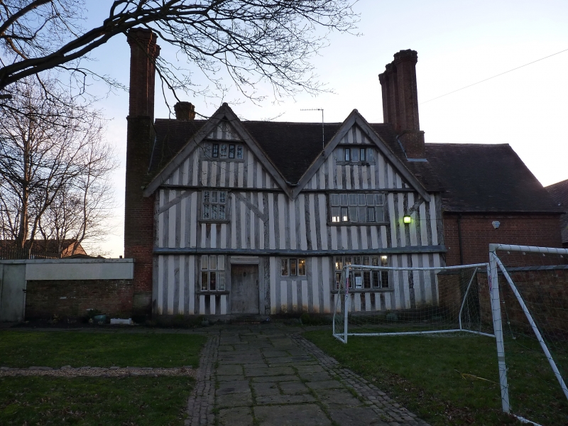
BELL'S LANE 1. 5104 Brandwood B14 No 157 (Bell's Farmhouse) (formerly listed under Northfield) SP 07 NE 17/14 25.4.52 II* 2. Late C16 to mid C17 substantial farmhouse. Two storeys and attic. Timber framed with red brick infill, later roughcast. Double gabled front and rear, the gables slightly jettied at attic level. Old tile roof. Original external chimney stacks to side elevations with tall coupled stair shaped shafts. Fenestration consists mainly of C19 wood casements. Central doorway giving access to axial passage, the door in an architrave (but hood missing). All main rooms of interior retain C17 panelling although some appears to be reset. Ground floor right hand room has palmette frieze - upper right hand room has remains of C17 plaster ceiling in 2 compartments, one with rosette and guilloche decoration, the other with an original arrangement with lions' masks. Dog leg staircase with surviving elements of splat balusters. The site of the house was moated to the west.
Listing NGR: SP0636178755
External links are from the relevant listing authority and, where applicable, Wikidata. Wikidata IDs may be related buildings as well as this specific building. If you want to add or update a link, you will need to do so by editing the Wikidata entry.


Other nearby listed buildings