Latitude: 53.3516 / 53°21'5"N
Longitude: -2.999 / 2°59'56"W
OS Eastings: 333598
OS Northings: 384321
OS Grid: SJ335843
Mapcode National: GBR 7YHP.J8
Mapcode Global: WH87L.X02X
Plus Code: 9C5V9222+J9
Entry Name: 59-63, Greendale Road
Listing Date: 20 December 1965
Grade: II
Source: Historic England
Source ID: 1075444
English Heritage Legacy ID: 215437
ID on this website: 101075444
Location: Port Sunlight, Wirral, Merseyside, CH62
County: Wirral
Electoral Ward/Division: Bromborough
Parish: Non Civil Parish
Built-Up Area: Bebington
Traditional County: Cheshire
Lieutenancy Area (Ceremonial County): Merseyside
Church of England Parish: New Ferry St Mark
Church of England Diocese: Chester
Tagged with: Building
BEBINGTON GREENDALE ROAD SJ 3384 SE (east side) Port Sunlight 14/113 Nos. 59 to 63 20.12.65 (consec)
G.V. II
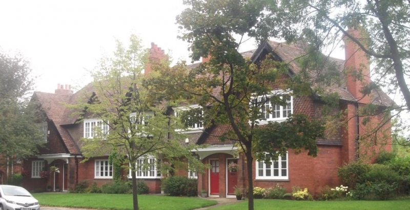
Terrace of 5 houses. 1899. By Maurice B. Adams. Brick with pebbledash 1st floor, fishscale tile-hung gables and tile roof. 2 storeys, 5 bays; central bays have jettied 1st floor on posts, end bays break forward under asymmetrical gables. Windows have small-paned casements of 4 lights, those to ground floor with gauged-brick flat arches, central rectangular bay window. 1st floor central 3 bays have gablets to windows, the central bay with canted oriel. Entrances have gauged-brick flat arches, end bays with paired entrances with flat canopies; plank doors with small- paned lights. 2 cross-axial and return lateral stacks.
Listing NGR: SJ3359884321
External links are from the relevant listing authority and, where applicable, Wikidata. Wikidata IDs may be related buildings as well as this specific building. If you want to add or update a link, you will need to do so by editing the Wikidata entry.


Other nearby listed buildings