Latitude: 54.2365 / 54°14'11"N
Longitude: -0.7204 / 0°43'13"W
OS Eastings: 483495
OS Northings: 483070
OS Grid: SE834830
Mapcode National: GBR RMDG.T2
Mapcode Global: WHF9X.XS32
Plus Code: 9C6X67PH+JR
Entry Name: School House
Listing Date: 5 February 1986
Grade: II
Source: Historic England
Source ID: 1074191
English Heritage Legacy ID: 439925
ID on this website: 101074191
Location: Thornton-le-Dale, North Yorkshire, YO18
County: North Yorkshire
District: Ryedale
Civil Parish: Thornton-le-Dale
Built-Up Area: Thornton-le-Dale
Traditional County: Yorkshire
Lieutenancy Area (Ceremonial County): North Yorkshire
Tagged with: House
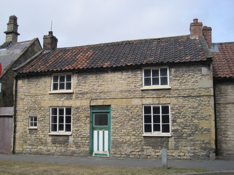
THORNTON DALE CHESTNUT AVENUE SE 8383 (north side) 14/88 No 5 (School House) GV II House. Mid C18; raised and altered early C19. Squared sandstone, with herringbone-tooled quoins to ground floor and bordered, snecked quoins to first floor. Pantile roof; brick stacks. Central stairhall plan, one room deep, with outshut. 2 low storeys, 2 window front. Central C20 door with overlight, flanked by 3-light, large-pane horizontal sliding sashes; firewindow at end left. Smaller 3-light, large-pane horizontal sliding sashes to first floor. Tripartite keyed lintels to ground floor openings. Coped gables and end stacks.
Listing NGR: SE8353483085
External links are from the relevant listing authority and, where applicable, Wikidata. Wikidata IDs may be related buildings as well as this specific building. If you want to add or update a link, you will need to do so by editing the Wikidata entry.


Other nearby listed buildings