Latitude: 52.8357 / 52°50'8"N
Longitude: -1.2837 / 1°17'1"W
OS Eastings: 448349
OS Northings: 326701
OS Grid: SK483267
Mapcode National: GBR 7HM.68W
Mapcode Global: WHDH9.7ZYH
Plus Code: 9C4WRPP8+7G
Entry Name: 59, High Street
Listing Date: 16 January 1989
Grade: II
Source: Historic England
Source ID: 1074168
English Heritage Legacy ID: 358166
ID on this website: 101074168
Location: Kegworth, North West Leicestershire, DE74
County: Leicestershire
District: North West Leicestershire
Civil Parish: Kegworth
Built-Up Area: Kegworth
Traditional County: Leicestershire
Lieutenancy Area (Ceremonial County): Leicestershire
Church of England Parish: Kegworth St Andrew
Church of England Diocese: Leicester
Tagged with: Building
KEGWORTH HIGH STREET SK 4826-4926 11/119 No 59 - GV II
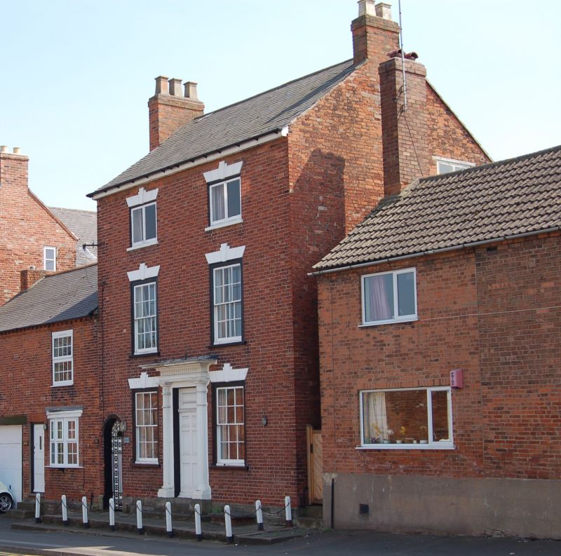
House. Late C18-early C19, with later C19 extensions and C20 alterations to rear. Red brick on dressed stone base, wooden eaves, slate roof, flanking brick chimneys. 3 storeys; 2 bays. Ground and first floors have boxed 3-pane sashes; second floor has C20 2-light wooden casements in square openings. All windows retain painted stucco voussoirs with triple keyblocks. To centre is a false 6-panelled door with panelledfanliqht and fine doorcase. This has slender fluted Doric columns with ringed necks, fluted frieze, and cornice hood. Approached by 2 concrete steps. To left of house is a passage with arched gate- way. Altered outshot and extensions to rear. C20 entry in left side. Interior has a staircase with stick balusters and ground floor front room remodelled c1830-40, with reeded ceiling cornice and foliated paterae. Cottage attached to left of house, with range of outbuildings to rear, now sometimes known as No 59A, is not included.
Listing NGR: SK4834926701
External links are from the relevant listing authority and, where applicable, Wikidata. Wikidata IDs may be related buildings as well as this specific building. If you want to add or update a link, you will need to do so by editing the Wikidata entry.


Other nearby listed buildings