Latitude: 53.8192 / 53°49'9"N
Longitude: -2.6661 / 2°39'58"W
OS Eastings: 356242
OS Northings: 436088
OS Grid: SD562360
Mapcode National: GBR 9ST8.LN
Mapcode Global: WH96L.08PG
Plus Code: 9C5VR89M+MG
Entry Name: Whittingham Hall
Listing Date: 22 June 1979
Grade: II
Source: Historic England
Source ID: 1073519
English Heritage Legacy ID: 185966
ID on this website: 101073519
Location: Cumeragh Village, Preston, Lancashire, PR3
County: Lancashire
District: Preston
Civil Parish: Whittingham
Built-Up Area: Whittingham
Traditional County: Lancashire
Lieutenancy Area (Ceremonial County): Lancashire
Church of England Parish: Goosnargh St Mary The Virgin
Church of England Diocese: Blackburn
Tagged with: Building
SD 53 NE WHITTINGHAM WHITTINGHAM LANE (off)
Whittingham Hall 5/119 22.6.1979 II
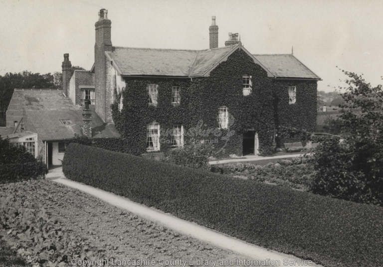
Manor house, subsequently farmhouse, now house. Probably earlier C17, much altered. Roughcast handmade brick on stone plinth, slate roof. Three bays, with projecting porch-cum-stairturret in centre, 2 small turrets at rear, various additions to left end and rear. Two storeys; wide 2-storey gabled porch has modern glazed and panelled door offset to right, inner porch with wide Tudor-arched inner doorway of oak, the lintel with an apex nick continued as an incised cross, studded board with ornamental strap hinges; stairlight windows on 2 levels, the 1st offset left and the other above the door, both sashed. All other windows are 12-pane sashes: to left 2 on each floor, to right one at ground floor and 2 above; in right gable one on each floor. Left gable has an extruded chimney stack, and continued to left is a large single-storey extension. Rear: middle bay flanked by narrow full-height gabled turrets (perhaps formerly garderobes), 3rd bay has rear-wall chimney; most of rear covered by large 2-storey lean-to. Interior: 1st bay has very large beam at end wall, like a hearth bressummer, and timber-framed partition wall with wattle exposed; ground floor room in 3rd bay said to have honeycomb-pattern coffered ceiling of carved beams, now concealed; dog-legged staircase with closed string, fielded panel newels, moulded handrail, panelled dado, but lacking balusters; roof of 5 kingpost trusses with curved struts, the east part apparently double-tiered, with a ceiling above the lower tie beams, which are chamfered.
Listing NGR: SD5624236088
External links are from the relevant listing authority and, where applicable, Wikidata. Wikidata IDs may be related buildings as well as this specific building. If you want to add or update a link, you will need to do so by editing the Wikidata entry.


Other nearby listed buildings