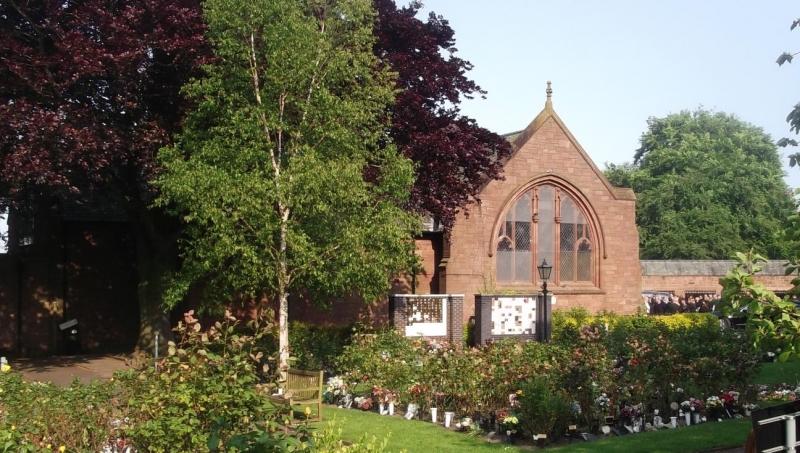
Latitude: 53.4359 / 53°26'9"N
Longitude: -2.9579 / 2°57'28"W
OS Eastings: 336462
OS Northings: 393668
OS Grid: SJ364936
Mapcode National: GBR 7BB.49
Mapcode Global: WH871.JWQT
Plus Code: 9C5VC2PR+9V
Entry Name: Crematorium at Anfield Cemetery
Listing Date: 19 June 1985
Grade: II
Source: Historic England
Source ID: 1072972
English Heritage Legacy ID: 359279
ID on this website: 101072972
Location: Anfield Cemetery, Anfield, Liverpool, Merseyside, L4
County: Liverpool
Electoral Ward/Division: Anfield
Parish: Non Civil Parish
Built-Up Area: Liverpool
Traditional County: Lancashire
Lieutenancy Area (Ceremonial County): Merseyside
Church of England Parish: Anfield St Columba
Church of England Diocese: Liverpool
Tagged with: Crematorium
SJ 39 SE PRIORY ROAD L4
4/932 Crematorium at - Anfield Cemetery
II -
Crematorium. 1894-6. Probably J. Rhind. Snecked stone and slate roof. T-plan building with south porch and north wing; north west tower. Porch has gable and pointed-arched entrance, no capitals. Tall gabled buttresses. Returns have 5-light windows with Perpendicular tracery; 2 king mullions with niches. Wing has 3-light windows with gables. Tower has angle buttresses supporting niches. Top louvred bell openings. Embattled parapet on corbel table and angle gargoyles. C20 extension to east. Interior has small chapel with arched opening and flanking arched entrances to furnaces behind. The 4th crematorium to be opened in the country.
Listing NGR: SJ3646293668
External links are from the relevant listing authority and, where applicable, Wikidata. Wikidata IDs may be related buildings as well as this specific building. If you want to add or update a link, you will need to do so by editing the Wikidata entry.


Other nearby listed buildings