Latitude: 53.4032 / 53°24'11"N
Longitude: -2.9722 / 2°58'19"W
OS Eastings: 335460
OS Northings: 390037
OS Grid: SJ354900
Mapcode National: GBR 77Q.11
Mapcode Global: WH877.9QXD
Plus Code: 9C5VC23H+74
Entry Name: Sunday School to North of Church of Saint Andrew
Listing Date: 14 March 1975
Last Amended: 19 June 1985
Grade: II
Source: Historic England
Source ID: 1072946
English Heritage Legacy ID: 359315
ID on this website: 101072946
Location: Liverpool, Merseyside, L1
County: Liverpool
Electoral Ward/Division: Central
Parish: Non Civil Parish
Built-Up Area: Liverpool
Traditional County: Lancashire
Lieutenancy Area (Ceremonial County): Merseyside
Church of England Parish: St Luke in the City Team
Church of England Diocese: Liverpool
Tagged with: Building
SJ 3590 SW RODNEY STREET (east side) L1
54/968 Sunday School to north of Church of Saint Andrew (formerly listed 14.3.75. as Building in Saint Andrew's Churchyard)
G.V. II
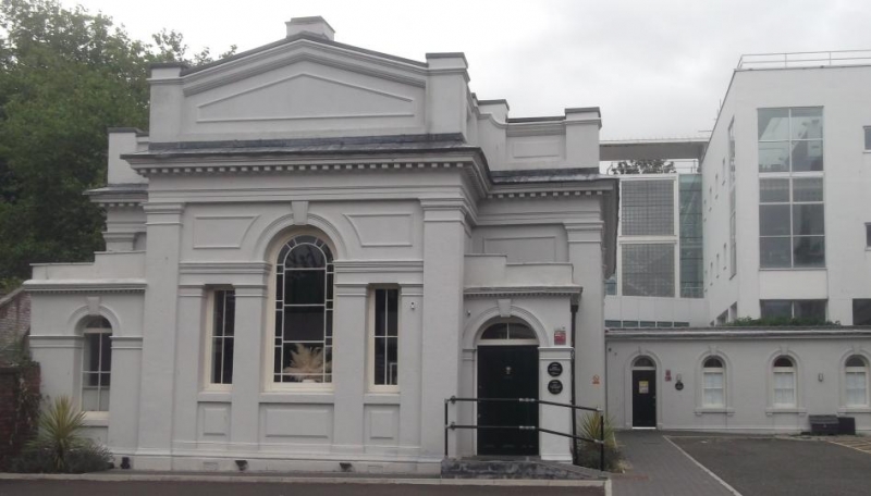
Sunday school. 1872. Stucco.L-shaped block attached to the church, single storey. Corridor wing from north of church has 2 doors and 4 windows, all round-headed in moulded architraves with keystones, larger rectangular building juts forwards at the end, with 4 round-headed windows on the side in pilastrade, a Venetian window on end facing road, with low flanking square porches, dentilled eaves, cornice and pediment.
Listing NGR: SJ3546090037
External links are from the relevant listing authority and, where applicable, Wikidata. Wikidata IDs may be related buildings as well as this specific building. If you want to add or update a link, you will need to do so by editing the Wikidata entry.


Other nearby listed buildings