Latitude: 53.8768 / 53°52'36"N
Longitude: -2.7929 / 2°47'34"W
OS Eastings: 347968
OS Northings: 442578
OS Grid: SD479425
Mapcode National: GBR 8RYM.40
Mapcode Global: WH850.2TBC
Plus Code: 9C5VV6G4+PR
Entry Name: Catterall Hall Farmhouse
Listing Date: 17 April 1967
Grade: II
Source: Historic England
Source ID: 1072920
English Heritage Legacy ID: 185432
ID on this website: 101072920
Location: Churchtown, Wyre, Lancashire, PR3
County: Lancashire
District: Wyre
Civil Parish: Catterall
Traditional County: Lancashire
Lieutenancy Area (Ceremonial County): Lancashire
Church of England Parish: Garstang St Helen, Churchtown
Church of England Diocese: Blackburn
Tagged with: Farmhouse
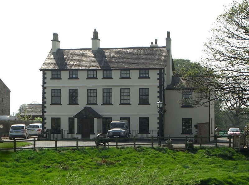
CATTERALL SD 44 SE 7/44 Catterall Hall Farmhouse 17-4-1967 GV II
House, probably mid C18, altered. Rendered brick with sandstone dressings and slate roof. 2 storeys with attic, 6 bays, with chamfered quoins and 2 bands. Attic now blind at front. Windows sashed with glazing bars, rendered reveals and stone sills. Ground-floor window of 3rd bay replaces door. Chimneys on ridge and to right of 2nd bay. Interior has chamfered ceiling beams, now papered over, and a stair of one straight flight with closed string, moulded handrail and turned balusters.
Listing NGR: SD4796842578
External links are from the relevant listing authority and, where applicable, Wikidata. Wikidata IDs may be related buildings as well as this specific building. If you want to add or update a link, you will need to do so by editing the Wikidata entry.


Other nearby listed buildings