Latitude: 53.839 / 53°50'20"N
Longitude: -2.8819 / 2°52'54"W
OS Eastings: 342064
OS Northings: 438440
OS Grid: SD420384
Mapcode National: GBR 8S91.WL
Mapcode Global: WH854.PRVV
Plus Code: 9C5VR4Q9+H6
Entry Name: Forest Farmhouse
Listing Date: 11 June 1986
Grade: II
Source: Historic England
Source ID: 1072052
English Heritage Legacy ID: 183573
ID on this website: 101072052
Location: Elswick, Fylde, Lancashire, PR4
County: Lancashire
District: Fylde
Civil Parish: Elswick
Built-Up Area: Elswick
Traditional County: Lancashire
Lieutenancy Area (Ceremonial County): Lancashire
Church of England Parish: Copp or Great Eccleston St Anne
Church of England Diocese: Blackburn
Tagged with: Farmhouse
This list entry was subject to a Minor Amendment on 8 October 2024 to reformat the text to current standards.
SD 43 NW
5/3
ELSWICK
HIGH STREET
Forest Farmhouse
II
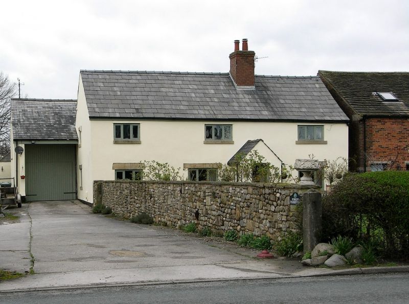
Farmhouse, probably C18 remodelling of C17 or earlier. Handmade brick, tile front now covered with grey render scored to resemble stone, slate roof with brick chimney just in front of the ridge. Three-bay baffle-entry plan. Two storeys; door in line with chimney at junction of second and third bays , three low three-light casements on each floor. Externally the principal feature of interest is the right gable wall (narrowly separated from the neighbouring barn) which incorporates two cruck blades.
Interior: standard C17 plan with central housepart, axially-partitioned first bay with parlour to front and dairy to rear, kitchen in third bay with spere, exposed beam and joists; fielded panel doors.
Listing NGR: SD4206438440
External links are from the relevant listing authority and, where applicable, Wikidata. Wikidata IDs may be related buildings as well as this specific building. If you want to add or update a link, you will need to do so by editing the Wikidata entry.


Other nearby listed buildings