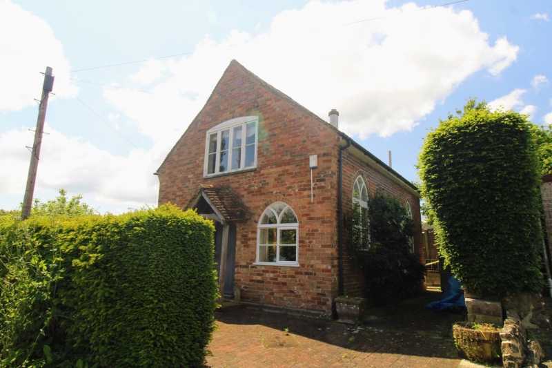
Latitude: 51.1422 / 51°8'31"N
Longitude: 0.8305 / 0°49'49"E
OS Eastings: 598091
OS Northings: 141908
OS Grid: TQ980419
Mapcode National: GBR RWV.6SV
Mapcode Global: VHKKM.BKX8
Plus Code: 9F324RRJ+V5
Entry Name: The Chapel
Listing Date: 10 October 1980
Grade: II
Source: Historic England
Source ID: 1071483
English Heritage Legacy ID: 180948
ID on this website: 101071483
Location: Great Chart, Ashford, Kent, TN23
County: Kent
District: Ashford
Civil Parish: Great Chart with Singleton
Built-Up Area: Ashford (Ashford)
Traditional County: Kent
Lieutenancy Area (Ceremonial County): Kent
Tagged with: Building
This list entry was subject to a Minor Amendment on 21 January 2025 to amend the name and address and reformat the text to current standards.
GREAT CHART
PADWELL LANE
The Chapel
(Formerly listed as The Studio, THE STREET)
II
Former methodist chapel. Early C19. Two storeys red brick. Tiled roof, half-hipped at one end. Two pointed Gothick windows and round-headed doorcase. Five braces.
Listing NGR: TQ9809141908
External links are from the relevant listing authority and, where applicable, Wikidata. Wikidata IDs may be related buildings as well as this specific building. If you want to add or update a link, you will need to do so by editing the Wikidata entry.


Other nearby listed buildings