Latitude: 51.1496 / 51°8'58"N
Longitude: 0.685 / 0°41'6"E
OS Eastings: 587887
OS Northings: 142357
OS Grid: TQ878423
Mapcode National: GBR QV4.S0G
Mapcode Global: VHJN2.TCHJ
Plus Code: 9F324MXP+V2
Entry Name: The Cloth Hall
Listing Date: 17 September 1952
Last Amended: 10 October 1980
Grade: II*
Source: Historic England
Source ID: 1071366
English Heritage Legacy ID: 181282
ID on this website: 101071366
Location: Smarden, Ashford, Kent, TN27
County: Kent
District: Ashford
Civil Parish: Smarden
Built-Up Area: Smarden
Traditional County: Kent
Lieutenancy Area (Ceremonial County): Kent
Tagged with: Cloth hall
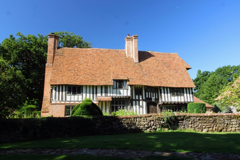
1. 5272 SMARDEN WATER LANE The Cloth Hall (formerly listed as Turk Farmhouse or The Cloth Hall) TQ 8742 23/71
II*
2. C15 timber-framed and close-studded building with plaster infilling, part of the ground floor rebuilt in red brick, the north-west end of the first floor and part of the centre oversailing on the protruding end of the floor joists and brackets. Tiled roof. Casement windows with diamond-paned or small square leaded panes. Blocked 4-centred wooden doorway. Iron-studded door, with peep-hole to the south-east of this. Two storeys. Five windows. Brick chimney breast with offsets on the south-east wall. North-west front has dragon post and blocked double window. The first floor of the north-west front oversails on the protruding ends of the floor joists and brackets, with a loft door in the centre of it approached by an outside ladder. Above is a second loft door with a projecting hip over it, from which is suspended a hoist with a heavy iron hook. C16 L-addition at north-west corner. Crown post roof.
Listing NGR: TQ8788742357
External links are from the relevant listing authority and, where applicable, Wikidata. Wikidata IDs may be related buildings as well as this specific building. If you want to add or update a link, you will need to do so by editing the Wikidata entry.


Other nearby listed buildings