Latitude: 51.0689 / 51°4'7"N
Longitude: 0.6941 / 0°41'38"E
OS Eastings: 588847
OS Northings: 133400
OS Grid: TQ888334
Mapcode National: GBR QW3.VPF
Mapcode Global: FRA D6B9.B76
Plus Code: 9F323M9V+GJ
Entry Name: Hales Place
Listing Date: 8 May 1950
Grade: II*
Source: Historic England
Source ID: 1071143
English Heritage Legacy ID: 179778
ID on this website: 101071143
Location: Tenterden, Ashford, Kent, TN30
County: Kent
District: Ashford
Civil Parish: Tenterden
Built-Up Area: Tenterden
Traditional County: Kent
Lieutenancy Area (Ceremonial County): Kent
Tagged with: House
1. 1715 OAKS ROAD
Hales Place TQ 8833 1/125 8.5.50.
II* GV
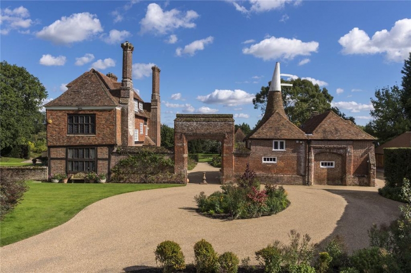
2. A large early Cl6 timber-framed L-shaped house which has been considerably altered at later dates. It is now fronted partly with red brick, partly with red mathematical tiles and partly with weather tiles, but one strip of timber-framing is still visible. Tiled roof. A few original windows with wooden mullions and diamond panes. Some C18 sash windows with glazing bars intact, and modern windows. Brick chimney stacks. Doorcase on south side with caryatid columns and four-centred arch. On the north side is a doorcase with a flat hood over supported by grotesque caryatids and a 10 panelled door. Good staircase, panelling, fireplaces and ceiling beams inside.
Hales Place and the listed buildings in the grounds form a group.
Listing NGR: TQ8884733400
External links are from the relevant listing authority and, where applicable, Wikidata. Wikidata IDs may be related buildings as well as this specific building. If you want to add or update a link, you will need to do so by editing the Wikidata entry.


Other nearby listed buildings