Latitude: 51.115 / 51°6'53"N
Longitude: 0.6422 / 0°38'31"E
OS Eastings: 585029
OS Northings: 138395
OS Grid: TQ850383
Mapcode National: GBR QVN.15M
Mapcode Global: VHJN8.27VL
Plus Code: 9F324J7R+XV
Entry Name: 19 and 21, High Street
Listing Date: 4 June 1952
Grade: II
Source: Historic England
Source ID: 1071015
English Heritage Legacy ID: 180155
ID on this website: 101071015
Location: Biddenden, Ashford, Kent, TN27
County: Kent
District: Ashford
Civil Parish: Biddenden
Built-Up Area: Biddenden
Traditional County: Kent
Lieutenancy Area (Ceremonial County): Kent
Tagged with: Building
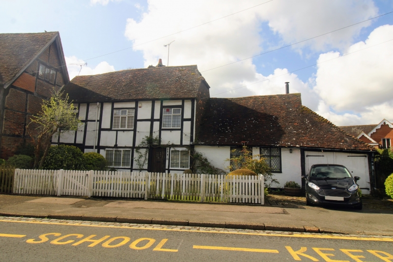
BIDDENDEN HIGH STREET 1. 5272 (south side) Nos 19 and 21 TQ 8538 16/52 4.6.52. II GV 2. Timber-framed building, C17 or earlier with plaster infilling. Two storeys. Half-hipped tiled roof. Three sash windows with glazing bars intact on the 1st floor, casement windows on the ground floor. Shed built out in front of the ground floor of No 19. Ground floor addition of painted brick to the west of No 21. This was once the Forge and outside it is a circular iron slab with a central iron stake about a foot high on which cart wheels were made. Contemporary paving of Bethersden marble forms footpath in front and extending to south-east about 12 yards.
Listing NGR: TQ8502938395
External links are from the relevant listing authority and, where applicable, Wikidata. Wikidata IDs may be related buildings as well as this specific building. If you want to add or update a link, you will need to do so by editing the Wikidata entry.


Other nearby listed buildings