Latitude: 51.0135 / 51°0'48"N
Longitude: 0.6148 / 0°36'53"E
OS Eastings: 583517
OS Northings: 127046
OS Grid: TQ835270
Mapcode National: GBR QWS.69V
Mapcode Global: FRA D65F.PCB
Plus Code: 9F322J77+CW
Entry Name: Newenden Bridge Rother Bridge
Listing Date: 16 August 1962
Grade: II
Source: Historic England
Source ID: 1070943
English Heritage Legacy ID: 180288
ID on this website: 101070943
Location: Newenden, Ashford, Kent, TN18
County: Kent
District: Ashford
Civil Parish: Newenden
Traditional County: Sussex
Lieutenancy Area (Ceremonial County): East Sussex
NEWENDEN 1. 5272 Newenden Bridge or "Rother" Bridge TQ 82 NW 11/248 16.8.62. II
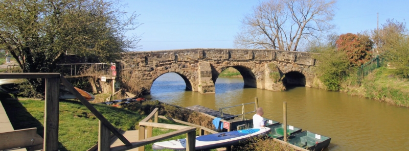
2. This is partly in Newenden Parish and partly in Northiam Parish, East Sussex. Sandstone. Built in 1706 but in the mediaeval tradition. Three round-headed arches with pointed cutwaters between them on the upstream side (their lower portions renewed in white brick) and shouldered buttresses on the downstream side. Parapet renewed with slender buttresses. Circular iron ties. A.177
Listing NGR: TQ8399327794


Other nearby listed buildings