Latitude: 52.7084 / 52°42'30"N
Longitude: -2.7535 / 2°45'12"W
OS Eastings: 349186
OS Northings: 312569
OS Grid: SJ491125
Mapcode National: GBR BJ.2GSF
Mapcode Global: WH8BT.P600
Plus Code: 9C4VP65W+9H
Entry Name: 40, Pride Hill
Listing Date: 10 January 1953
Grade: II
Source: Historic England
Source ID: 1070650
English Heritage Legacy ID: 457807
ID on this website: 101070650
Location: Shrewsbury, Shropshire, SY1
County: Shropshire
Civil Parish: Shrewsbury
Built-Up Area: Shrewsbury
Traditional County: Shropshire
Lieutenancy Area (Ceremonial County): Shropshire
Church of England Parish: Shrewsbury St Alkmund
Church of England Diocese: Lichfield
Tagged with: Building
SHREWSBURY
SJ4912NW PRIDE HILL 653-1/11/491 (South East side) 10/01/53 No.40
GV II
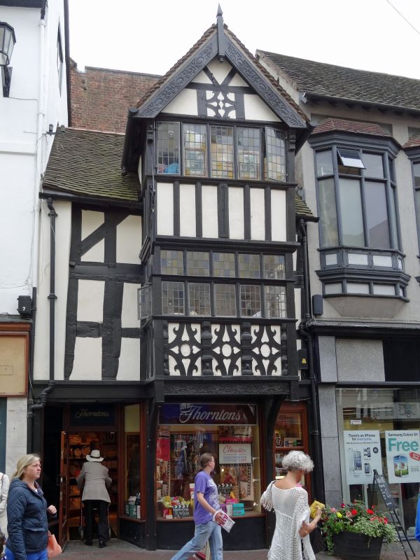
Shop, possibly originally shop with dwelling. Early C16 with additions of C17. Timber-framed with plain tiled roof. 3 storeys, single-window range. Late C20 shop front, then exposed timbering to upper storeys, square panels with arch bracing. Square projecting full-height bay is an early C17 addition, with 5-light mullioned and transomed window to first floor, 4-light casement window above. Balustraded studding and cusped quatrefoil panels below the first-floor windows. Small balcony added each side of this central bay, probably c1900. Central gable over, with enriched barge-boards and finial. (Smith JT: Shrewsbury: Topography and Domestic Architecture to the Mid C17: 1953-).
Listing NGR: SJ4918612569
External links are from the relevant listing authority and, where applicable, Wikidata. Wikidata IDs may be related buildings as well as this specific building. If you want to add or update a link, you will need to do so by editing the Wikidata entry.


Other nearby listed buildings