Latitude: 53.3825 / 53°22'57"N
Longitude: -2.9315 / 2°55'53"W
OS Eastings: 338136
OS Northings: 387701
OS Grid: SJ381877
Mapcode National: GBR 7HY.VF
Mapcode Global: WH87F.Y76Q
Plus Code: 9C5V93M9+2C
Entry Name: Duffus
Listing Date: 14 March 1975
Grade: II
Source: Historic England
Source ID: 1070639
English Heritage Legacy ID: 359102
ID on this website: 101070639
Location: Aigburth Vale, Liverpool, Merseyside, L17
County: Liverpool
Electoral Ward/Division: Greenbank
Parish: Non Civil Parish
Built-Up Area: Liverpool
Traditional County: Lancashire
Lieutenancy Area (Ceremonial County): Merseyside
Church of England Parish: Mossley Hill St Matthew and St James
Church of England Diocese: Liverpool
Tagged with: Building
SJ 3887 MOSSLEY HILL DRIVE L17
38/762 No. 6 (Duffus)
14.3.75. G.V. II
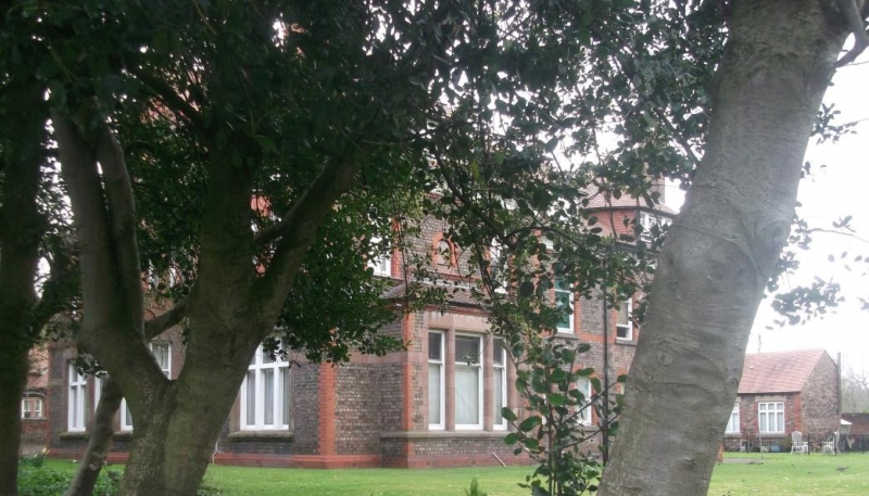
House. 1880s. Common brick with red brick and stone dressings, tiled roof. 2 storeys with attic and 3 bays. Central bay breaks forward under entablature with pulvinated frieze. String course over ground floor, 1st floor, sill course and coved eaves with Jacobean plasterwork. Ground floor windows have casements; central canted bay window with parapet with terracotta panels. 2:3:2-light 1st floor windows have sashes. Central tripartite dormer with pediment, flanking canted roof dormers with hipped roofs and small-paned casements. Tall end stacks. Porch to left return has arched window with leaded lights.
Listing NGR: SJ3813687701
External links are from the relevant listing authority and, where applicable, Wikidata. Wikidata IDs may be related buildings as well as this specific building. If you want to add or update a link, you will need to do so by editing the Wikidata entry.


Other nearby listed buildings